
Building the Pamir Trail
In 2021 a small team set out to explore the possibly hardest section of the Pamir Trail. Filmmaker Michel Fakhoury joined us on this journey and shot these incredible images. Friends of the Pamir Trail Rana Labs turned the footage into this short edit. Apart from showing the beauty of the Pamirs, in this short film we explain a little more what we are trying to achieve with this long-distance hiking trail.

A Short Walk in the Afghan Pamirs
Pamir Trail founder Jan Bakker shares his story on a traverse across the Pamir Mountains on the Afghanistan side deep in the Wakhan Corridor. This route will be added to the Pamir Trail at the end of 2025.
Pamir Trail founder Jan Bakker shares his story on a traverse across the Pamir Mountains on the Afghanistan side, deep in the Wakhan Corridor. This route has been added as an extension to the Pamir Trail.

Wakhi people living in harsh conditions above 4000 metres
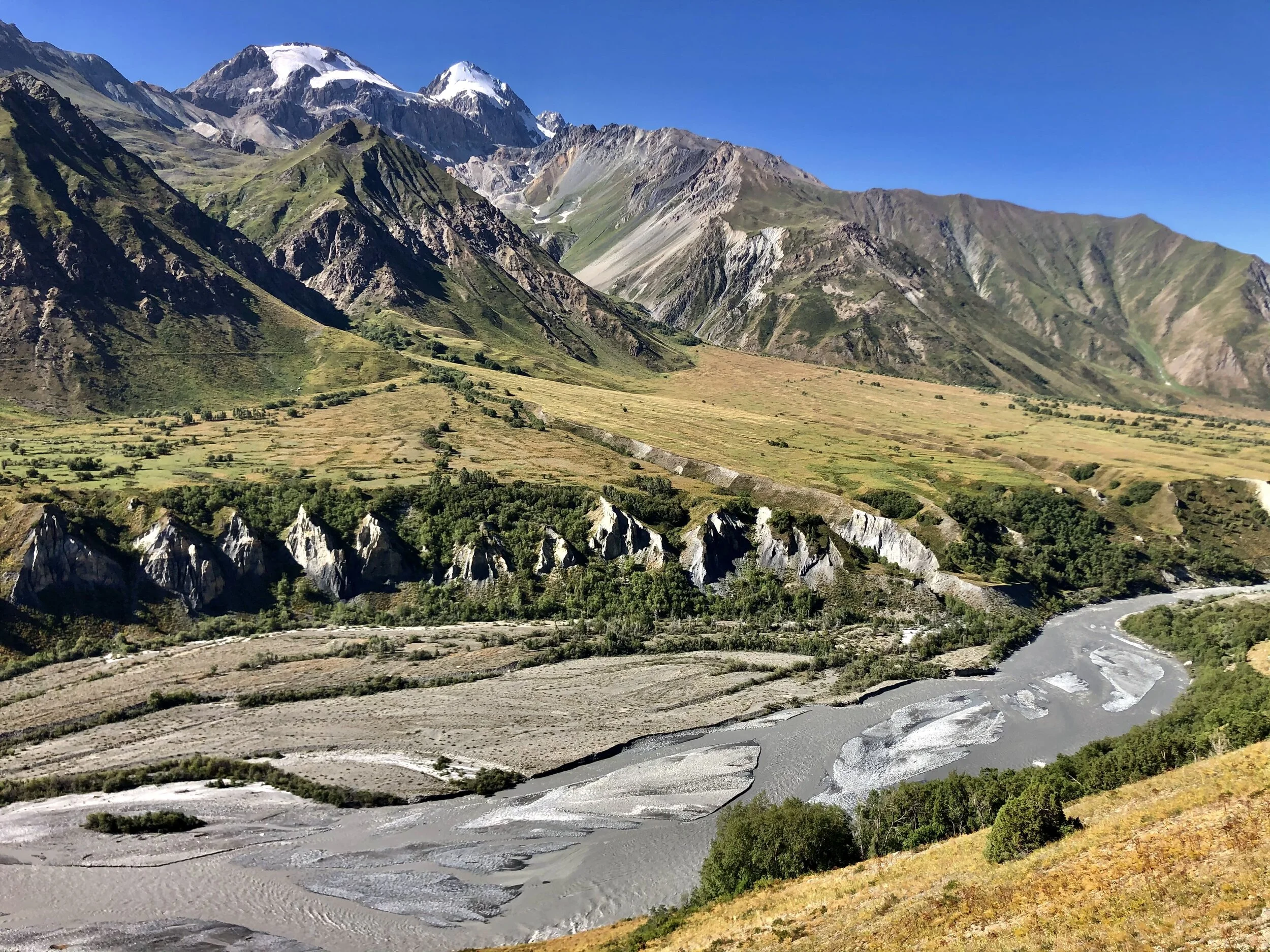
Dushanbe, the capital of Tajikistan, was scorching hot as usual. With temperatures of over 40 degrees Celsius we did not want to waste any time here. The Toyota Land Cruisers were ready to take on the infamous Pamir Highway, a high altitude road that connects Tajikistan with southern Kyrgyzstan. It’s one of the most scenic drives in the world, but also one of the roughest as it runs right through the heart of the Pamir Mountains. It’s essentially a dirt track, despite its qualification ‘Highway’. We were headed in a slightly different direction, towards a thin slice of land wedged between two formidable mountain ranges: the Wakhan Corridor.
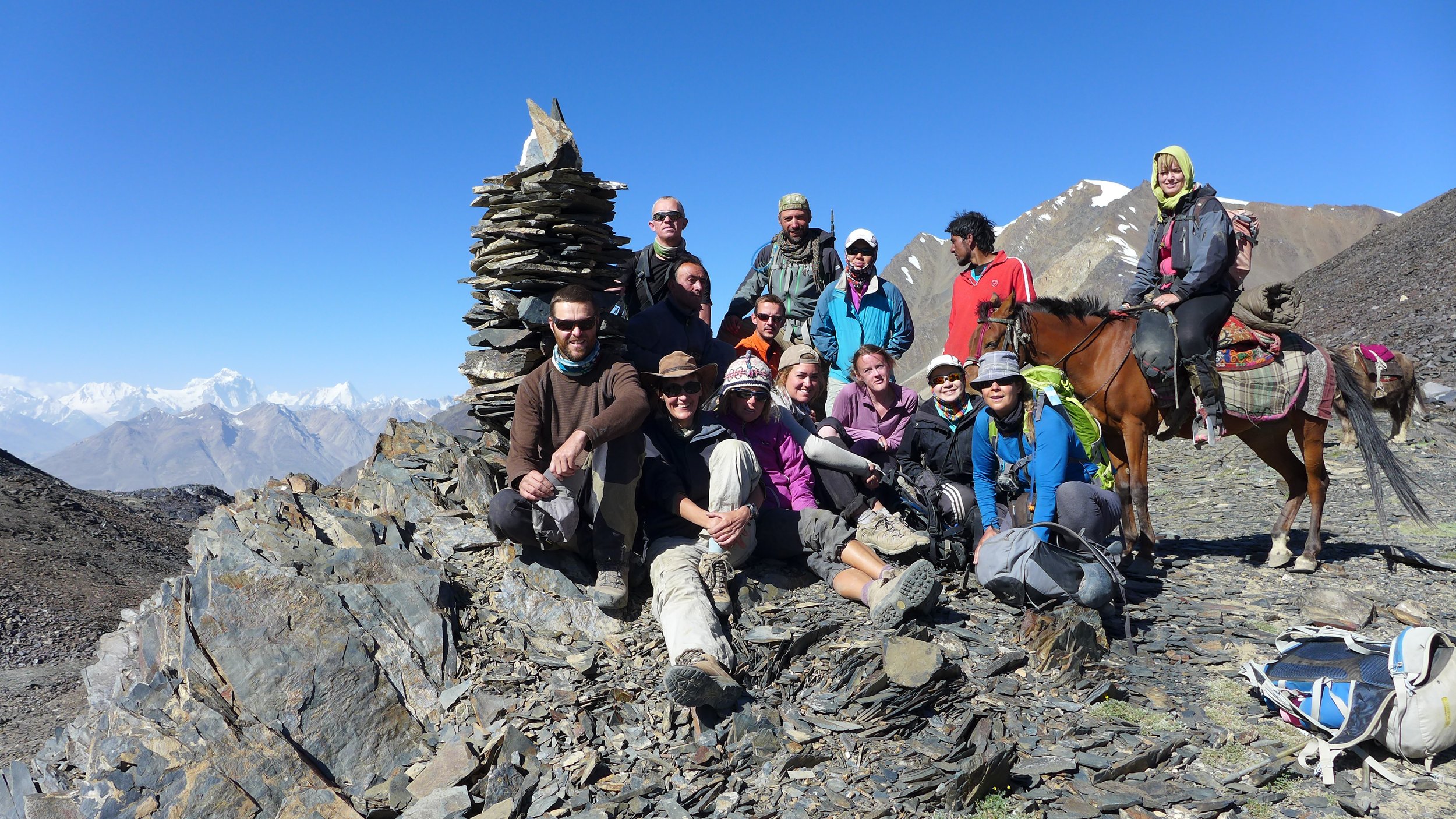
Along with fellow group leader Luca, I was guiding a 12-strong team on an exploratory trek for expedition company Secret Compass. Our team aim was to trek between Afghanistan's Pamir Mountains and high altitude deserts, meeting and learning from the Wakhi and Kyrgyz shepherds who call this remote and harsh landscape home.
Our multi-national team (six nationalities!) had people from all walks of life and with varying ability levels. There were young British and Australian women, an expedition literature academic, an well-travelled Dutch couple with plenty of similarly high-altitude experience under their belts, a Singaporean lady who had summited the 8201 metre high Cho Oyu and an engineer on leave from a super yacht trying to get as far away from water as possible! They all had one thing in common. They all ventured out here to quench their thirst for adventure in this last frontier of high altitude trekking.
The Wakhan Corridor is a panhandle-shaped strip of land in the far northeast of Afghanistan. The gateway to this remote mountain region is the border town of Ishkashim. The southern border of Pakistan is guarded by the spiky, glaciated peaks of the Hindu Kush. Just 12km north of this frontier, the upper reaches of the Panj River separate the Afghan Wakhan from Tajikistan. And 300km further east is the heavily militarised border of China’s Xinjiang Province. The mountain passes which continue into the neighbouring countries are strictly off-limits which makes the Wakhan a dead-end street: one way in, one way out.

Travelling by 4X4 was certainly not a luxury option. The heavily potholed road and its rickety bridges were making the journey itself a proper adventure. Add suspicious Tajik army officers and rockfall-prone cliffs and you’ve got yourself an epic road trip. For much of the journey we followed the wild, roaring Panj River, known as the Oxus in ancient times. On the opposite side of the river we could see a dangerously exposed donkey trail carved into the vertical walls, connecting the isolated villages found in this part of Afghanistan. Our fixer got off the phone with the commander of the Afghan border post. It was Ramadan and the border police wanted to call it a day. They were tired and hungry. He managed to convince them to stay open a little longer and after an hour of hair-raising driving the Land Cruisers reached the bridge that connects Tajikistan with Afghanistan. Leaving Tajikistan was not a problem. Getting into Afghanistan proved to be a bit harder. My fellow expedition leader Luca was summoned to a small backroom where he was told that the entire border post had waited just for us, a special service. And special services have special price tags. Once the ‘privilege’ was paid for and after a quick check of our duffle bags -for alcohol and other contraband- we were good to go. Welcome to Afghanistan!

The road into the Wakhan Corridor requires 4X4
The Wakhan Corridor is steeped in history. It was one of the lesser-known Silk Road routes into China when it was still an independent kingdom, and Marco Polo described it when he travelled through the Wakhan in 1271. During the so-called Great Game era (a shadow play between Tsarist Russia and the British Empire in the 19th century) the Wakhan Corridor became the political centre of attention. The borders of the two super powers came too close for comfort and both parties agreed on the creation of the Wakhan as a buffer zone.
Malang Darya, our local guide, was a local legend, responsible for a newer slice of Afghan history. He shot to fame in Afghanistan when he and a fellow Afghan climber reached the summit of Afghanistan’s highest peak, Mount Noshaq (7492m). As part of the Wakhan Tigers, as the group of climbers called themselves, he became a symbol of hope and determination. This extraordinary feat was covered in the press nationwide and made him an instant celebrity. Wherever Malang goes, in spite of his charming and gentle character, he demands respect. While he was taking care of the local permits, I went to the Ishkashim market to arrange the food for the expedition. Following the 2013 Secret Compass expedition to the Wakhan, essential kitchen kit and equipment had been left behind in a certain guesthouse for future use. Alas this kitchen inventory had miraculously disappeared so I quickly set about locating more gas stoves, cutlery and a couple of pressure cookers. An army of adventurers marches on its stomach.

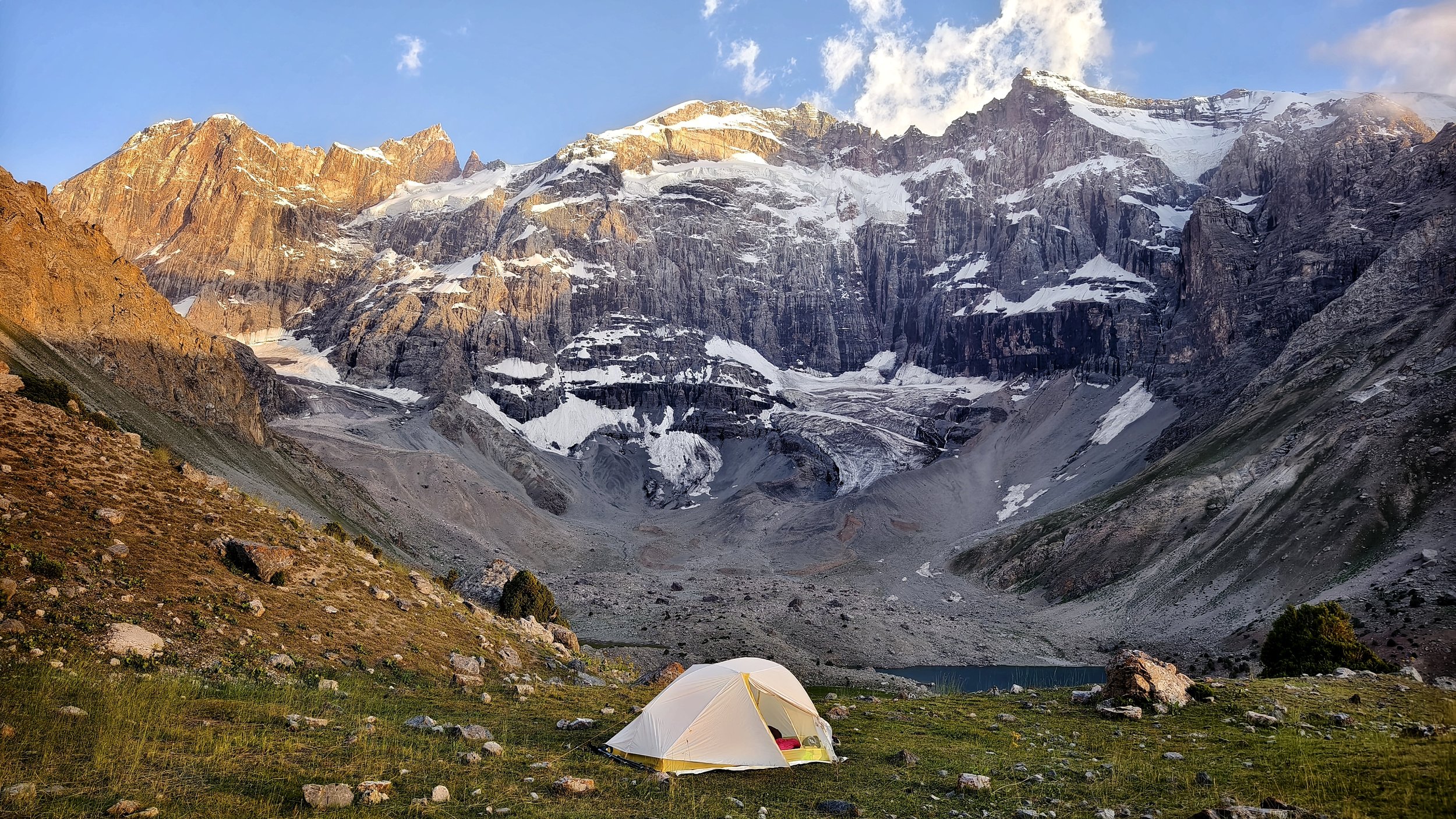
Sunset in the Pamirs
With logistics taken care of in Ishkashim we still had to drive another 200km towards Sarhad-e-Broghil, the trailhead of our trek. The road zigzagged its way up seemingly impenetrable terrain and gradually it dawned on us why the driver had planned two full days’ driving for this 200km journey. The worn-out jeeps braved enormous pits of sand and rock and the fast-flowing rivers that drain the meltwaters of the Hindu Kush. Despite all the wildness, the Wakhan Valley felt like a true Shangri-La. We passed charming settlements, where women in red robes were working the land and children were joyfully chasing our cars.
It was hard to imagine that this place is one of the most extreme habitable places on earth during winter. Temperatures can plummet to a bone-chilling minus 30 degrees Celsius and heavy snowfall can make the roads impassable for most of the winter. In summer the Wakhi work hard to make their homes ready for winter time. Life is extremely tough for the 10,000 inhabitants of this forgotten corner of Afghanistan.
Past winters can affect the summer visitor too. Last winter there had been more snowfall than usual. As a result, the raging Wakhan River as it is called on this stretch, was in places bursting its banks. At the settlement of Sargaz our vehicles could not continue anymore. The road wasn’t just flooded, it had been completely swallowed by the river. One of the drivers was almost swept away while wading in, trying to prove that we were really unable to go any further. We were lucky that Sargaz is blessed with a hot spring - an excellent spot to discuss Plan B!
Our original plan had been to end the trek in a settlement called Wuzed, just half an hour downstream from Sargaz. After contemplating pros and the cons with Malang and Luca, we decided on an apparently radical change of plan: to do the entire trek in reverse, clockwise instead of anticlockwise. The first two days would be hard, as we would gain lots of vertical metres in a short period of time. And we weren’t sure whether we would be able to arrange enough pack animals at such short notice. Malang proved his value once again - it pays to have some star power in Afghanistan. The next morning, 17 grunting yaks were eagerly waiting to haul the 895kg of food and equipment to higher elevations.
Our first day started well: after half an hour we were standing in front of a fast-flowing, chest-deep river. The yaks appeared to be immune to any current and ferried the team members to the other side. The trail then climbed steeply into a deep, bone dry-gorge that would eventually lead us to the Big Pamir plateau. When we looked over our shoulders we could see the ocean of mountains and the glaciers of the Hindu Kush laid out before us.

Yak river crossings are a thing!
As our caravan reached the first mountain pass of over 4,500m we stared into the remote interior of the Afghan Pamirs. This high altitude desert fringed by 6,000m peaks is the domain of the elusive Marco Polo sheep and its mighty arch-enemy, the snow leopard. We descended to the bottom of the valley to set up our camp next to a yurt settlement. The hospitable Wakhi inhabitants offered us an Afghan version of yak butter tea, quite similar to its Tibetan counterpart. This salty and somewhat rancid liquid is excellent, as long as you think of it as a hearty soup. Some of us were not convinced! However, after a long day of dry air and high altitude, we could definitely use some salts to recuperate from the exercise.
The next day we climbed up the Big Pamir, a dusty and windswept plateau at over 4,000m. In the north, the mountain giants of the Tajik Pamirs dominate the horizon. Our goal was to reach Manjulak, a yurt settlement tucked away in a surprisingly green, lush valley with a crystal clear glacial stream. It was hard to square this beautiful location with the Afghanistan of news reports. We entered the guest yurt for a welcoming cup of tea. Amidst the smoke of the yak-dung fire, we sat on colourful blankets and carpets, while our hosts were dressed in those striking red robes, traditional dress for Wakhi women. Outside, the sun had disappeared behind the tall ridge and instantly the air turned bitterly cold. Still, the elderly women were milking the yaks while the shepherds were coming down from higher grounds with their goats and sheep. This daily routine is gruelling, but reminds the traveller that life is tough in these remote regions.

Yurt settlement tucked away in the Afghan Pamirs
It’s not only the daily grind that make life here a challenge, however. As we progressed east we entered Kyrgyz territory. The ethnic group of around 1500 Kyrgyz nomads roam on what they call Bam-I-Dunya, or the Roof of the World. In contrast to the Wakhi, who return to lower ground at certain times of year, the Kyrgyz live permanently above altitudes of over 4000m. The only available fuel to heat the yurts in the brutal winters is dried yak dung. Due to the lack of access to medical facilities and endemic malnutrition, this part of the Wakhan Corridor has one of the highest maternal mortality rates in the world (160 of every 1000 babies do not survive birth). In 1978 the majority of the Kyrgyz population were granted asylum in Eastern Turkey after the Shaur Revolution, locally known as the “Last Exodus”. Those left here live a life close to that of their ancestors, but full of hardship. The team were delighted to meet the children of our temporary hosts, but as we handed over instant photographs of one baby or another, it was upsetting to think that, in a matter of months, the photograph might be a memento of a child no longer alive.
Leaving our gracious hosts behind, we moved on. As we skimmed the foothills of the multiple unclimbed 5000m+ peaks of the Afghan Pamirs, we could see the deep blue waters of Lake Zorkul in the distance. This striking landmark was once thought to be the source of the Oxus. The first known European to have visited this lake in modern times was Scottish naval officer and explorer John Wood in 1838. Unfortunately we didn’t have time enough to explore the lake ourselves, as we were heading for Mula, another Kyrgyz settlement, this time situated on the higher slopes of the Pamirs.

Yaks carry the big bags across the Pamirs
This was the last inhabited place we were staying at before one of the most important aims of the expedition – crossing the 4895m high Showr Pass. We settled ourselves into another cosy guest yurt. Although visitors are comparatively rare here, many villages maintain a space for them, either erecting a yurt specifically for their arrival, or asking a designated family to move in with neighbours to allow guests some space of their own. In Mula it was as if the circus had come to town. At the small entrance of the yurt a dozen Kyrgyz were pressing to catch a glimpse of what we were doing. Which in fact was: lying down in our sleeping bags, knackered from a long day’s walk. Nevertheless, it all appeared to be mighty interesting. Later in the day we learned that we had to take a compulsory (but welcome!) resting day. There were no horses - the pack animal of choice in this area - available for the next day. A delay during an expedition is normally something undesirable. However, if a game of buzkashi is the cause, there is no reason to complain!
Buzkashi is Afghanistan’s national sport and is also played in other parts of Central Asia. This game, rough and exhausting for both horses and riders, is played on a big flat and often dusty pitch. It’s ‘every man for himself’ (and it is only men), and the aim is to sink a dead headless goat's/sheep's corpse into a hole in the ground. Horsemen try to steal the corpse from a competitor and score a point. We went down to the buzkashi pitch, along with the local Kyrgyz crowd. It was as if we were going to see a football match. Our expedition chef, Inayat, turned out to have additional talents to the provision of tasty meals. He proved himself to be an excellent buzkashi player, often leaving the Kyrgyz competition in a cloud of dust. Cheering the players was not without risk. The pitch itself didn’t have any boundaries, so occasionally we had to run for our lives to avoid being trampled. It’s a spectacular and intense sport, dust flaring up around the charging horses in front of a mountainous backdrop – our rest day, initially an inconvenience, had turned out to be an expedition highlight.

The rough game of buzkashi in full action
It was day eight of the expedition and it was time to leave Kyrgyz territory. After a relatively short day of walking we set up camp at a deep blue glacial lake, close to the foot of the Shawr Pass. We were all well-acclimatised and confident the whole team would be able to scale the pass. We got up early that night so we would reach the top of the pass before the heat. Getting up in the dead of night to tackle a mountain pass or summit is magical: the anticipation of the climb itself and the incoming morning light is worth the 3am alarm call. The team huddled together at a roaring yak dung fire and tried to shove down some breakfast and then we were off. An almost invisible goat track worked its way up the pile of scree and boulders, passing more stunning lakes and tumbling glaciers. After five hours of climbing we all stood on the top of the nearly 5000m high Shawr Pass, with the sun now fully risen, taking in the views of the jagged peaks on the other side and wondering just what was supposed to be ‘little’ about the ‘Little Pamir’.

Crossing the glacier just after the Shawr Pass
The successful crossing of the pass was celebrated with a hearty meal of mutton at the settlement of Chapdara. This was a welcome addition to our daily intake, since the team were starting to feel the effects of such a lengthy stay at altitude. Despite Inayat’s lovely food we were served every day, we were burning more calories than we could put back into our systems. However, the end of the trek was now in sight. On day 11 we tackled the last pass, at 4725m still higher than most summits in the Alps. The Hindu Kush came back into view as we made our last descent into the Wakhan Valley. After many days of otherworldly trekking we reached the green, fertile river banks of Sarhad-e-Broghil, where we received a warm welcome, and a soak in the warm water of the long-anticipated hot spring.
To our relief the 4X4’s made it to Sarhad, and we said our reluctant farewells to the Wakhan. There were four days of bumpy road ahead as we moved back towards Dushanbe, and plenty of time (when not jolted by potholes) to think about all we had experienced. Many of us, amazed by the mountains and fascinated by our nomadic hosts, were promising to return. Insha’allah.

The camp before the Shawr Pass


Thru Hiking the Roof of the World
In the summer of 2024 long-distance hikers Michaela Hrda and Martina Merisi from Czechia became the first people to thru hike the Pamir Trail . We’re excited to share an interview we did with them shortly after they returned to their home country.
An interview with the first thru hikers of the Pamir Trail. All photos and videos are taken and owned my Michaela Hrda and Martina Merisi

Pamir Trail thru hikers Michaela Hrda and Martina Merisi on the shores of Sarez Lake
How do you test a brand new long-distance hiking trail that has not been hiked in one push before? Every section of the Pamir Trail (bar one, section 7) was tried and tested by various trekkers who helped exploring the route. But until 2024 no one had hiked the entire thing yet. In spring 2024 the Pamir Trail team received an email from Michaela Hrda, an avid long-distance hiker from Czechia, who expressed an interest in hiking the complete length of the PT. We officially hadn’t finished researching the final section yet, section 7, but this was a big opportunity to beta test the route. Together we would figure out section 7. During the run up to Micha’s departure mid-July with her hiking partner Martina Merisi we tried to tackle some of the challenges, from going through the existing trail beta of the route to the logistics of resupply. For the latter it was a bit of second guessing for us as well. Plus the route has around 80 stages and an e-visa would grant only a stay of 60 days. Plenty of unknowns (which was great as we got to figure the whole process out by just doing it).
Shortly after Micha and Martina returned home, I had a conversation with the couple about their experiences. Below the article you can find the full recording of this interview. It is not the best quality but it does give you a sense of what it was like!

Camping near the Gushkhun Pass on section 7
Hi! We are very grateful to have you and superkeen to hear all your stories of the hike. You are the first people to have thru hiked the Pamir Trail, which is an amazing achievement. Would you mind introducing yourself?
Michaela: I’m a teacher back in Czechia and I’m also a writer. Because I’m a teacher I have the summers free to go on big adventures like these.
Martina: I’m a writer, photographer, traveller and coach. I love people and nature and was able to tag along with Michaela. I’m always looking for experiences that broadens my knowledge and inspiration. Doing something pioneering and unknown has been a dream since I was a child.
How do you feel now?
Martina: Thinking back of our Pamir Trail adventure is surprisingly emotional. We thought we had processed everything on the trail, not expecting a post-trek blues but we did our first lecture on the Pamir Trail yesterday and the final video made me cry, which made the entire venue cry. We relived the experience again. Now I see the trail differently. I forgot how difficult it was sometimes. Also my point of view changed. The level of risk was something I haven’t experienced before. Besides that the kindness and the generosity all came back to me. The people in Tajikistan made us feel home and I would love to share this experience with other people. I hope anyone who is coming to Tajikistan will have a similar experience. Maybe except for the landslides sections haha.
Michaela: I feel grateful we were able to do it and survived it haha. Same for the beautiful people we met along the way. And proud that we did manage to pull it off! But I'm happy to be home and I crazily enjoy the food I get to eat again. I’m really happy to be home!
Picture perfect camp spot with the impressive Mirali Wall in the background
Have you recovered physically and mentally already or are you still recovering?
Michaela: At the end we weren’t really devistated physically nor mentally. Our body has gotten used to hiking day in day out. Although the final part of the trail was at high altitude it was not not difficult, we were just hiking a bit little slower. As Martina said, we processed the adventure on the trail itself so there was no real post-trail blues. I was already looking forward to doing the presentations back in Czechia, seeing my friends and my dogs. It’s just excitement now.
Martina: I don’t think we had to recover so much. Only the lack of good sleep is catching up on me. I would love to have one day of rest. After finishing the trail we have been travelling a lot and preparing the presentation. I’m not sure when I can start sleeping properly again, hopefully soon.
Which long-distance hiking trails have you done before? And how do they compare with the Pamir Trail?
Michaela: I started out with a few shorter ones like the Alta Vias in the Dolomites, which are still some of my favourites. I’ve done the Tour du Mont Blanc, I have crossed Iceland, I hiked through Madeira. More recently I did the John Muir Trail in the USA, one of the longer treks. And I did a combo of the Via Alpina Red and Yellow in the Alps. All of these routes had visible trails throughout, the PT sometimes does not have a path. The other routes don’t have overgrown parts and landslides areas. The PT is definitely the most difficult trail I have done so far, none of the others were as intense as this.
Martina: I experienced somewhat similar terrain in New Zealand on the Te Araroa regarding missing trails, but it was nowhere as technical and the scale in Tajikistan is something else. Often it was continuous hard terrain for long distances, whereas on other routes it’s often a small section.
How did you find out about the Pamir Trail?
Michaela: The guy I hiked the Via Alpina with talked to me about the Pamir Trail. Kyrgyzstan was actually on my radar first. But after his mention I did some research on the Pamir Trail online, listened to some podcasts with you and that got me excited to go for it. I really wanted something away from civilisation. The Alps have become too crowded and developed and on the Via Alpina I was walking through villages everyday. We were camping and that was always near civilisation. That’s not why I go to the mountains. Plus it’s not that exciting in terms of people. Locals in the Alps mind their own business, as they are used to tourists. I was longing for an off the beaten track experience where I could connect with pristine nature more and have unexpected meetings with the local mountain people. And that’s exactly what the Pamir Trail is about.
Martina: Misa approached me if I knew a guy that could join her. Yes, she wanted a guy! Then I said, hold on, I would love to do it! She couldn't find anyone and my plans were not set in stone yet. So I asked her: why don’t we go together? It was great and I’m very grateful for that. I had some reservations as people are an important reason for me to go to the mountains and I was afraid the Tajik mountains were too remote with no locals around. Also I didn’t speak Russian (still a major language in Tajikistan). In the end, I was amazed and still am.

Hiking section 8, for both Michaela and Martina an absolute favourite part of the Pamir Trail
How did you communicate with the locals?
Michaela: I have been learning Russian a few years ago for a trip to Georgia. It’s pretty similar to Czech so it’s fairly easy for us to learn. Overall it was quite easy to communicate with the locals in most places. Only in the super remote villages without schools, like Ghorif, Russian (or English for that matter) was not spoken. But with hands and feet you get pretty far. Russian was otherwise fine.
What were your experiences with people throughout the PT?
Michaela: Wherever you go, the people in northern Tajikistan and the Pamirs are extremely hospitable and kind. Honestly they are the best people I have ever met. I have travelled to 50 countries and the people in Tajikistan are the nicest people I have met so far.
Martina: In northern Tajikistan the women did not want to be photographed which we of course respected. In the Pamirs the people didn’t mind this so much. There were some obvious differences in religion as well, in the Pamirs the majority in Ismaeli, a somewhat more relaxed form of Islam and you could sense that in daily life.

The people on the Pamir Trail make the hike very special
What rating would you give the Pamir Trail on the scale of 1 (very easy) - 10 (extremely hard)?
Michaela: (Silence for a moment) It's hard to rate the trail as a whole thing. Some parts were very easy, like section 8 and section 9, as there were trails. But there were extremely difficult parts, 10+. The second half of section 2 and 3 were the most difficult part for us, I would give that a 10. Both mentally and physically. Fann Mountains were not so easy. But that was maybe because we were fresh on the trail and not used to hiking every day yet. We were also pushing it a little in terms of distances. There was a 27 km day, which made us realise it was too much. We decided to enjoy the trail and not focus on the time pressure anymore, even if it meant we wouldn't make it.
Martina: I would say an 8 for the trail overall. But yes, some bits were a lot harder than others. It’s also the length of the trail and the fact that on some parts there are several difficult days in a row, which makes it mentally tough. It also depends on your experience level. We have quite a bit of experience in technical terrain, but a beginning hiker may find certain bits extremely hard, 10+.
Is the trail for anyone?
Michaela: Absolutely not. Certain sections like 1, 8 and 9 are fine for hikers with some experience, but the other is for expert hikers only. Even intermediate hikers may want to think twice before tackling the thru hike of the PT. I am a rock climber and have done glaciers so I was confident on parts of the trail with steep and glaciated terrain.
Martina: You need to be mentally strong and not afraid of intimidating terrain. Vertigo is on some parts of the Pamir Trail not a good thing to have. Some bits are very exposed.

The terrain on some of the Pamir Trail sections is pretty extreme and definitely not for everyone
What about navigation? Was it difficult? What tools did you use to find the way?
Michaela: We used the best map application in the world, the Czech one mapy.cz haha. That was it.
Martina: I was really surprised the navigation part was very easy. When there is no trail you just need to know the direction right. When there was a trail it was easy to follow.
Michaela: Even though there weren’t trail markers or any signing it was straightforward. Occasionally we missed a turn and had to go back a little, but the (open source) digital mapping really worked well.
How did you organise your food supplies along the trail?
Martina: We brought around 45 kg of food from Czechia. We were supported by a company called Adventure Menu, who make very tasty freeze-dried food. We brought some oats as well. In Dushanbe we spent a lot of time calculating how much food we needed on the various sections. Micha was super awesome with the food distribution and packages for drop off. She was in touch with some locals about the drop off locations. Without the resupply packages, I’m not sure how we would have managed. Sometimes there was nothing to buy, no shops at all. Maybe only Chinese soups and bread.
Michaela: I probably lost 7-9kg doing the trail even though we had our own food most of the time. I can’t imagine eating ramen, eggs and bread for almost three months. Resupply along the route is very much needed. This was definitely one of the biggest challenges before we left. We started organising some of the packages in Samarkand, Uzbekistan. After crossing the border into Tajikistan, we stopped at the crossroads leading to the villages in the Fann Mountains and gave local taxi drivers packages to drop off at the home stays. Our mistake was that we passed through in the evening, when drivers don’t go to the villages. You need to make these arrangements in the morning! That’s when the drivers are there and don’t forget to take their number plus the homestay numbers where the packages are dropped off. Greenhouse Hostel in Dushanbe were super helpful. They organised some deliveries in the Pamirs with the help of tour guides and companies and they did this for free! Huge thank you to them.

Freeze dried food is the way forward on most parts of the PT
How light weight did you go?
Martina: I was kind of light weight, compared to previous trips. Base weight 8 kg. I didn’t want to compromise on my hard shells so I was 1kg heavier than Michaela. Fully loaded with food added 5 kg to the weight. In the second half of the PT we brought an ice axe and warmer sleeping bags, adding another 1.5kg. On section 6 we anticipated hiking for 10 days straight without resupply so we had 17 kg in total. But we bypassed the original route due to snow so in hindsight it wasn’t needed.
Michaela: That was without water. But we never carried more than half a litre as there was water almost everywhere, except the end of section 5 and the start of section 7. When we changed for warmer equipment in Dushanbe (after our visa run to Uzbekistan) we carried a bit more and as we were already very trail fit we thought it was going to be ok. However, I felt the difference in weight. But my whole body was in pain. I was so sore.
Martina: I could not have done the PT with the set up I had in New Zealand. This was a very light approach for me. Micha and I are built differently, she is 54kg, I am 70kg. Heavier hikers might find the trail a bit harder due to the steep ups and downs.
Michaela: Shoes are another thing. We did it on trail runners. Instead of crampons we used strap-on micro spikes for the glaciated bits of the route. The micro spikes were even more helpful for the landslide areas that are crumbly and steep. I would never do the Pamir Trail in heavy hiking boots, despite the rocks and scree. I had no blisters at all.
Jan: I can imagine on some sections with scree and rocks people may prefer hiking boots. Especially the parts where rocks move.
Michaela: One time it was a bit dicey, with a boulder half my body size rolling onto my thigh. I had to hold it and jump away quickly. I have never experienced something like this, it's pretty scary!

Ultra light set up for the PT
What was the best and the worst part of the Pamir Trail?
Michaela: A number of times we said to each other: this is the best view of the trail! Fann Mountains are a definite favourite. And section 8 with all the lakes, especially Lake Sarez. It was also the most emotional as well. Apart from the variety and beauty of the scenery it’s also the people along the Pamir Trail. They make the Pamir Trail what it is. Worst? Landslide passages on the trail, hands down. Those were awful.
Martina: I really loved the second half of section 2. It was hell as well, especially the approach to the Dushokha Pass. It was one of the hardest passes. But the pass was pretty awesome too. I just love that area. The end of section 5 is another favourite. I love the green, hilly character of the landscape and the fact that it is a bit of a ridge walk. I’m not so much into glaciers. It reminded me of Scotland. Yet the high Pamirs were in full view, with these giant mountain peaks in the distance. Absolutely stunning. And I also thought section 8 is great. Beautiful. The worst part for me was the descent into the Yazghulom Valley from the Gushkhun Pass. The trail went straight into a landslide area, and it was horrible terrain. I fell in a rocky bit, got trapped and got a little hurt. Luckily Micha helped me with my rucksack.
Michaela: Oh I’d like to add one more. I love green meadows with glaciated peaks in the background. That was on the first two stages of section 6. It had a red coloured river running through the valley. Unreal.
What are the trail stats?
Michaela: Not sure exactly yet? We did roughly 1300 km in total with probably around 60,000 metres of vertical gain. We had 69 walking days plus 5 days of rest and recovery. We did have some lifts on roads, maybe 100km on the Pamir Highway as it was very unpleasant to walk.
(Michaela and Martina bypassed the Starghi Pass and the Upper Vanj valley due to snowfall. They crossed the Psoda Pass that leads to Qalai Khumb. After that there is no walking trail to Vanj).
Pro tips?
Martina: Wear long trousers! I would have saved a lot of bad words!
Michaela: You wouldn’t have so many names Jan haha. For me it’s micro spikes for the landslide parts. And of course hiking poles, although most people would bring those anyways.
Thanks a lot for sharing your story! If you want to know more about Michaela and Martina and their adventures, you can check the links below.
Michaela’s media platforms
Instagram and Facebook: @misketravels - Website: misketravels.cz
Martina’s media platforms
Instagram and Facebook: @dusenacestach - Website: dusenacestach.eu

An Explorer’s Account of Finding the Beob Pass
One of our Pamir Trail explorers made a successful traverse from the Zerafshan valley to the Rasht Valley, a crux passage that took a few years to find. This achievement resulted in the connection of the northern part of the Pamir Trail. This is his story.
The crossing from the upper Zarafshon Valley to the Rasht Valley was, in historical times, quite easy. There was just the minor obstacle of the Pakshif-Ghorif Pass, which was open from late May to October. From Ghorif a traveler could venture straight downriver through the Ghorif Gorge to the Rasht Valley, then known as Qarotegin or Gharm. But, like many old historical routes, it relied on small bridges and “ovrings” (traversing cliffs with wood and rocks stacked up to create a flat trail). The explorer Willy Rickmers (1906) and the botanist Nikolai Vavilov (1916) both visited Ghorif and then went downriver with horses.
Now, over a century later it is not only impossible to go down the gorge with horses, but even just on foot. The locals say a very difficult climb up or down the gorge is possible by early October when the water drops low enough to walk in the river. Two French climbers made it up the gorge from the Rasht side on September 10-11, 2022, see here for their account. But they noted that the trip involved dangerous rock climbing sections on cliffs to avoid the river in multiple locations. It is not simply scrambling, but actually dangerous free solo climbing alternating with a very dangerous walk along a raging river where a single slip could lead to drowning.
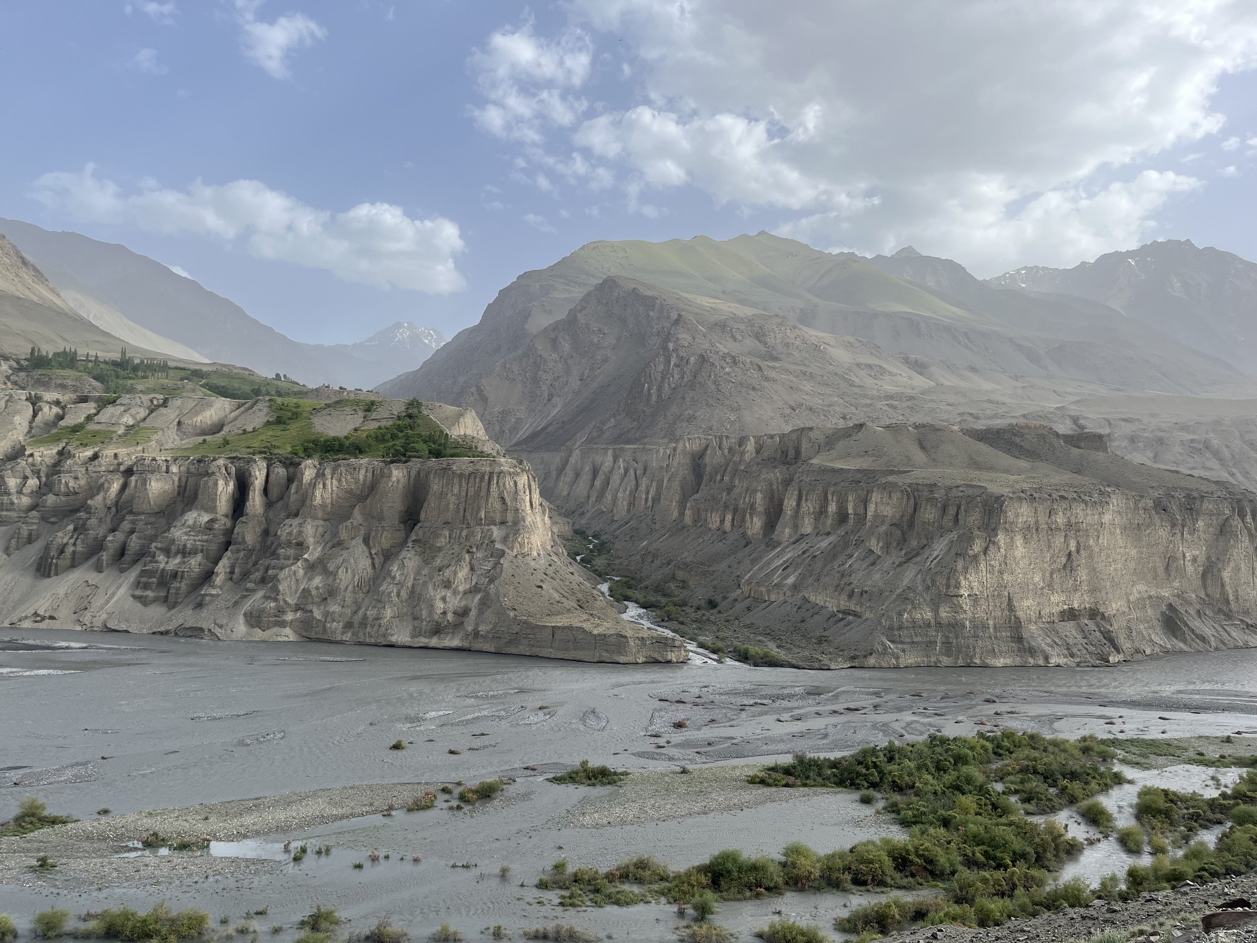
The mighty Zerafshan River, one of the sources of the Amu Darya river
The initial reasons for this route to be abandoned are not clear. It may be that a longer route around the mountains from Samarkand to Hisor to Gharm became easier for long distance travelers throughout the 19th century for a variety of reasons. Or perhaps the 19th century decline of the Kyrgyz in the Rasht Valley (who had earlier pushed into this area to graze their flocks, displacing the original Tajik and Eastern Iranian-speaking population) led to the route being left to fade.
The final and main blow to historical high routes in mountain areas in Tajikistan was twofold: Soviet roadbuilding that created faster and safer routes elsewhere, negating the need for high passes, and Soviet genocidal policies against mountain farmers and livestock herders. Assessing mountain agriculture and livestock as having no value to a modern industrial economy (and finding mountain people and nomads hard to control), Moscow deported mountain populations en masse to cotton plantations in the lowlands. Many died in the process of deportation and hard labor on collective farms, and the survivors’ memory of their mountain homeland began to fade. In their absence the trails faded, bridges collapsed, and knowledge of exact routes was lost.
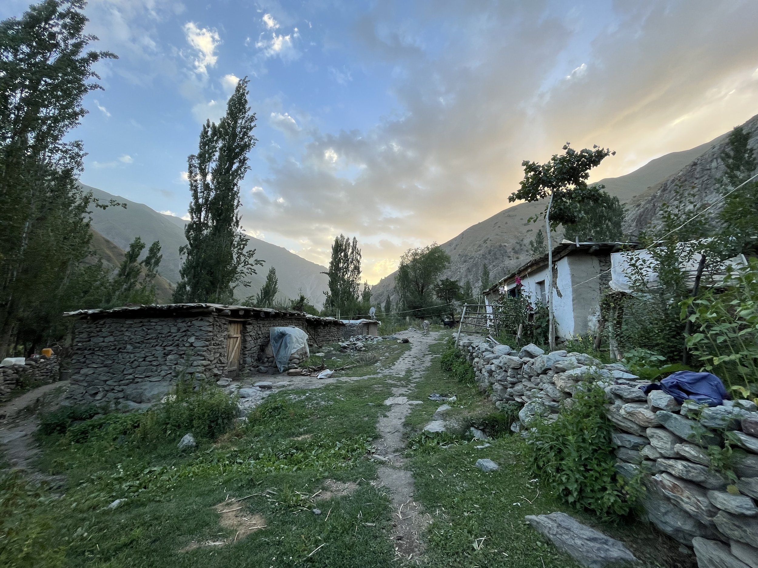
Ghorif, the most remote village in Tajikistan
By the 1970s and 1980s, Soviet policies became less restrictive and people were allowed to return to rebuild their mountain villages in this region. Overpopulation at collective farms played a part, as did a new Soviet economic directive to produce more meat - meaning the return of shepherds to mountain areas. While people on the lowland collective farms often suffered from malnutrition and poverty, the majority ethnic European and Russian population of Central Asian cities like Dushanbe and Tashkent had a much higher standard of living and demanded a steady supply of food from rural areas. This sent more and more shepherds to the high mountains. With the return of shepherds to the mountains came the rebuilding of trails and bridges.
When a Russian and Ukrainian climbing team descended to Ghorif from summiting a nearby peak in 1992, they expected to find an abandoned village, but instead found 4-5 families living there. However, Ghorif was the only village on the south side of Pakshif-Ghorif Pass to be repopulated - and at a lower population level than lived here before. Other villages like Namnarud and Khoja Nasrud, along with many other smaller villages, were never rebuilt. These villages remain as ghost towns, featuring small stone houses with collapsed roofs and abandoned farm fields and orchards gone wild. There are still many abandoned farm areas that were never revived. Bears eat the fruit and nuts in abandoned orchards, and cattle and sheep graze on fields that never returned to life. A good example can be found at the Dashti Rabot meadows upriver from Ghorif. The flat field here is lined by rocks that were removed for plow agriculture, and next to a spring lies an old millstone that once ground wheat into flour. This area is now home to cattle that graze the grass, but no more crops.
View from Ghorif to the north
Meat remains a product in Tajikistan that flows from rural areas where people rarely eat meat, to urban areas where the wealthier population enjoys a higher protein diet. The increasing concentration of wealth in Dushanbe and Khujand has pushed wealthy livestock owners to boost production by expanding grazing areas in the mountains, a process that involves new bridge building and the maintenance of trails. But the division of grazing area rights has created unconnected areas. Contract shepherds from the Zarafshon valley and elsewhere in northern Tajikistan bring their employers’ flocks through the Pakshif-Ghorif Pass and up the Namnarud Gorge. But they no longer connect over the ridge to the Rasht Valley side as they used to. And on the Rasht Valley side you will find contract shepherds who bring flocks all the way from southern Khatlon province. Nobody crosses the ridge anymore. Places like Khojai Muso Pass and Sari Jazira Pass are no longer used, and as a result are inaccessible to travelers.
There is no incentive for the wealthy livestock owners to build bridges and ovrings in the Ghorif Gorge, as that would not connect them to areas they have grazing rights for. And the smaller number of animals that are actually owned by locals (cattle, usually) graze the areas close by the villages and in dead-end gorges nearby. They have no incentive to build infrastructure as they don’t have the rights to graze the best grass above their villages.
Bridge at the Puli Mirzo
A further complication has been the creation of international borders, leaving options such as the Khojai Muso Pass in restricted border zones. The result, for the mountain traveler wanting to travel between the upper Zarafshon valley and the Rasht Valley, is to go through a number of difficult mountain passes. After some investigation, it appears that the Beob Pass is the best option - confirmed by a 2023 visit to Ghorif when the locals said that was the best way to get to the Rasht Valley. However, as the head of Ghorif village stressed, the last group of travelers to go through that pass did so 40 years earlier in the 1970s.
A late July 2023 solo hike confirmed that Beob Pass is passable, but not without some difficulty. After the abandoned village of Namnarud there is no longer any sort of trail. The route is open terrain and, being in an area of Tajikistan with higher rainfall and limited grazing, the Beob Gorge is overgrown with a jungle of high weeds. At the top the gorge gets steep and steeper and you must navigate the boulders and rocks fields of old and new glacial moraines before a final sketchy ascent to the pass on glacier and a steep rock pitch.

Glacial lake at 3680m near the Beob Pass
Beyond Ghorif the terrain becomes wilder, with bear scat seen regularly and thorny brush pushing over the trail. After Ghorif I didn’t see another person until the Rasht Valley side on the third day of hiking. By the standards of western Tajikistan, this is quite an isolated and wild area. Anybody who hikes through this area will need a high degree of confidence to hike independently. Danger is always waiting with every river and bridge crossing, and the Beob Pass is not a certain thing. It may be an unpredictable scrambling on glacier and steep rock. Another danger is presented by the weather, with the ridges here getting hit regularly by storms and with much higher precipitation than the Fann Mountains or the Pamirs. A well planned selection of clothing and tent is required.
The people here are very friendly and hospitable and will engage with you in a way that they wouldn’t in the parts of Tajikistan that regularly see tourists. While hiking up the Ghorif Gorge a shepherd resupply caravaneer tried to convince me to hike back down to Pakshif to stay the night with his family. He settled for me taking a selection of tomatoes, cucumbers and bread from his resupply bags. Farther up the gorge two shepherds coming down suggested I go down with them and spend the night at their camp. After the pass I had shepherd resupply caravaneers stop to offer me advice and assistance. The sole shepherd camp on that side was manned by a solo shepherd who also offered a place for the night in his large shepherd tent. In Ghorif I was greeted by several people and a larger number of curious children. I was shown to their new guesthouse and given a mattress, blankets and dinner. I ended the hike near Navobod where I had to turn down multiple offers of free accommodation in people’s homes.

Looking north from the Beob Pass (4030m), the crux pass of the PT’s section 4!
This area is the best option for connecting a thru-hike of Tajikistan. However, it will never become a popular tourist destination. The area is just too isolated, the hiking too difficult, and there is a lack of any single major attraction. There is no huge turquoise blue alpine lake, nor is there a massive glacial icefall that you can walk up to. The area is instead full of subtle beauty: a birch forest of the type you can only see on one other location in Tajikistan, a gorge overgrown with a jungle that elsewhere would have been deforested long ago if next to a road, a small mountain village emerging from destruction (Ghorif), and alpine grasslands and flowers that you won’t find in the drier or overgrazed parts of Tajikistan.

View of the Darai Mazor River

Connecting the Dots
Our 2022 recce team researched two high-altitude mountain passes of over 4400 metres to connect section 9 on the Pamir Trail. Read the story here.
Lines on the map. Lines that penetrate seemingly impenetrable mountains. I’m fascinated by them. When I started exploring trekking routes in the Pamirs back in 2009 the best available topographical maps were Soviet era maps, that luckily someone took the effort to scan and publish on some obscure website. At the time I would digitally stitch these maps together, print them and laminate them. In this day and age, we are spoiled for choice. In recent years mapping applications popped up like mushrooms, riding the wave of the increased popularity of outdoor activities like hiking, biking and trail running. However, using those apps for mapping trekking routes in one of the most remote mountain ranges on the planet seemed a little ambitious.

Short recce hike in the Duzakhdara Valley. Picture Jan Bakker
During one of the Covid lockdowns in 2020 I started working on an idea I had for long time. Connecting trekking routes throughout Tajikistan to create a long-distance hiking trail, the Pamir Trail. I had been researching routes for the Cicerone guidebook Trekking in Tajikistan for a number of years and creating a thru-hike seemed like a logical next step. Tajikistan is one of the most mountainous nations on the planet with a whopping 93% considered mountain terrain. For millennia shepherds have carved out an extensive network of pathways that connect valleys and mountain ranges.

Peaceful Duzakh Village. Picture Eilian Huisman
After a spectacular drive on the Pamir Highway our recce team is dropped at the bottom of the Duzakhdara Valley. A local Pamiri friend chuckles when we share our plan to explore this particular valley as it is translated as “the valley of hell”. On the map it doesn’t look all too bad and it would make the perfect connection between the Bartang and Wakhan valleys, stitching up 15 stages in the southern part of the Pamir Trail. We spend the night in Duzakh, a sweet little village at 3300 metres. Fall has arrived and the leaves of the birch trees are vibrant yellow. It’s a stark contrast with the earthy colours of the mountains around us. This is the last settlement we will see for the next eight days. Our route traverses a part of the Shugnan Range from west to east, a remote part of the Pamirs with a host of 5000m+ peaks. We are here to recce two high mountain passes we know very little about. The use of high-resolution satellite images and open-source maps gives us an idea what the terrain might look like. Still, rivers could be too big to cross, pathways may have been swept away by landslides or the pass may be impassable.

Excellent trail high above the Duzakh River. Picture Eilian Huisman
The first stretch of the valley of hell is not a hell at all. The trail is marvelous, winding its way high above the valley floor. The side valleys on the opposite side reveal glaciated giants, each one reaching easily over 5000m in altitude and likely unclimbed. We pitch our tents on the sandy shores of a small glacial lake, despite the bear pawprints. In the late afternoon, when the sun almost touches the ridgelines, we spot a cloud of dust in the distance. A herd of Ibex is plunging down an impossibly steep gully, not bothered by the boulders that are dislodged in the process. This valley is wild!

How desolate can a landscape get? Picture Eilian Huisman
The approach of the Duzakhdara Pass, our main objective for this expedition, runs through a seemingly endless U-shaped valley. The only living creatures here are ourselves and a massive herd of yaks, with a very agitated alpha male bull. It is throwing some charging moves at us, prompting us to make a d-tour behind a small ridge, out of sight. A vague path continues along a crystal-clear stream all the way to top of the pass. On the southern horizon looms the final frontier of the Pamir Trail, the Shakhdara Range with Pik Engels (6507m) and Pik Karl Marx (6723m) dominating the skyline. A small dip in the range marks the Vrang Pass, the final hurdle to the terminus of the trail at the Afghan border. The descent looks easy and I know we have succeeded in finding the missing link of the southern stretch of the Pamir Trail.

Duzakhdara Pass baby! 4400m and pretty epic views. Picture Jan Bakker
We’re headed east now towards another unnamed and unmapped pass of almost 5000m high. This pass could serve as a route variation in case the main route becomes impassable. The trail ascends up the vast high-altitude desert of the Murghab Plateau. The land is arid with snowcapped peaks, deep blue lakes and hardly any people. The altitude doesn’t drop below 3500m and at night it is bitterly cold. We chose to do this trip in September, weather wise possibly the most stable month of the year in the Pamirs. It’s also the month that night temperatures decrease dramatically. The stark surroundings of our camp are somewhat unsettling and makes us feel vulnerable. It’s our first night above 4000m and the mercury has plummeted to a bone chilling -10 Celsius, inside the tent. In the morning, the inner tent is plastered in a crust of ice. Nobody’s making a move until the morning sun hits the tent.

Checking the map. Picture Eilian Huisman
Up till now the mapping app has shown dotted lines we could follow. Now, we’re about to enter a valley with no hiking routes marked and an unnamed pass of 4770m high. The topo map shows contour lines, a few mountain lakes and glaciers. We’ll rely on these features to navigate and make the crossing of that pass. The highest lake at the foot of the pass, Oqkul, looks brilliant and we decide to set up camp for a couple of nights to explore the area. We have our eyes on a 5300m high peak, with what seems like a doable approach. As we get closer, we realise that the climb to the final ridge is steep with loose, rotten rock. Not worth it. In front of us is a long glacier that winds its way up to another high ridge. That seems much more feasible and attractive.

Walking along the shores of Turumtaikul at 4200m. Picture Jan Bakker
Out of the blue Kim, probably our strongest team member, asks me whether I’m ok. I have been moving very slowly this morning, and not feeling fit at all. I’ve been pushing away the fatigue by simply denying it, but being confronted by Kim’s question I realise that four weeks in the Pamirs has started to take its toll. The honest answer is that I’m not ok. I turn back as the rest of the team shuffles up the glacier. I stumble back to our camp, crash inside my tent and allowing my body to surrender to the fatigue.

The highest camp at Oqkul (4350m) and the 4770m pass in the background. Picture Jan Bakker
After a 13-hour night in the sleeping bag I feel a bit better, psyched for the grand finale. The pass looks fairly easy, despite the lack of trails. It’s a long day to our final destination, a desert settlement called Bulunkul. This is officially the coldest inhabited place in Central Asia with a recently recorded low of -65 Celsius. After an easy climb we reach the top of the pass. We look across the endless desert plain of the Murghab Plateau with a distinct white pyramid poking out on the horizon. That must be Kongur, an almost 8000m high peak in Chinese Xinjiang and the eastern boundary of the Pamirs. We did it. We found a second hiker’s passage between the Bartang and the Wakhan valleys, once more connecting the dots of another section of the Pamir Trail.

Yak dung fire at our Oqkul camp. Picture Derk Hardwick

On top of the 4770m high unnamed pass with the Murghab Plateau filling the background. Picture Jan Bakker

Lots of stunning lakes around the Oqkul area. Picture Kim van der Leeuw

Almost in Bulunkul! Picture Eilian Huisman

Bukunkul street scene. Picture Kim van der Leeuw
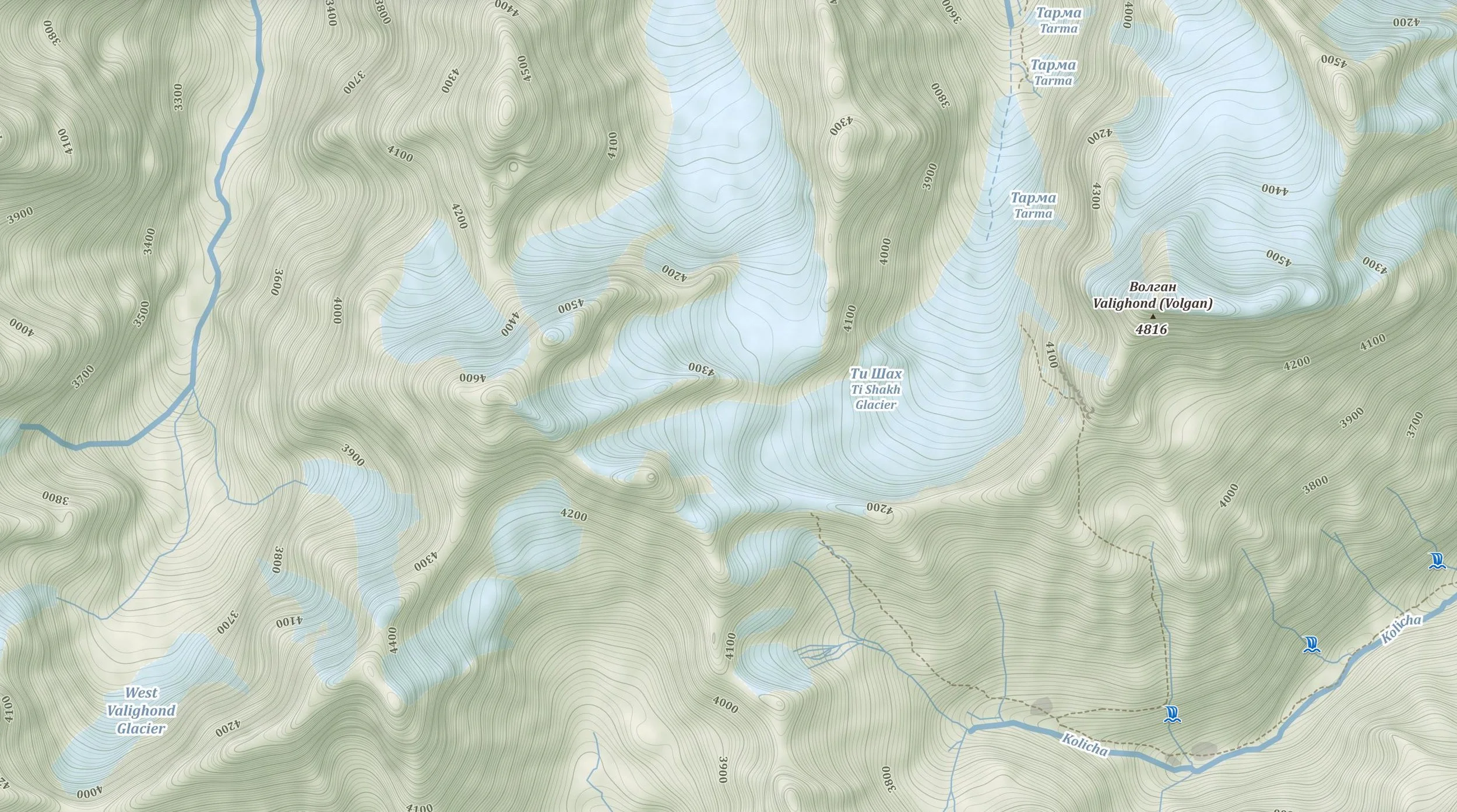
A shepherd’s journey across a Zerafshan Pass
A shepherd’s caravan epic mountain journey across the Zerafshan Valley

Source: mapy.cz / OpenStreetMap
The Pamir Trail still does not have a confirmed route from the Zerafshan Valley to the Rasht region. We explored a remote mountain pass called Ti Shakh (4130m) in the heart of the Zerafshan Range to establish if this could be a route that’s suitable for hikers and free of any hassle from the border authorities. Watch this beautiful and informative film, giving an insight what it’s like to explore virtually uncharted territory in the wild mountains of Tajikistan. See here or click on the map to view.

A trail dog called Sioma
What if a small pup tags along on your trek? This article tells the story of four days of trekking with a mountain pup in the Hissar Mountains, part of section 2.
I’m not a dog person. At all. I think dogs smell, always need attention and are too dependent on their humans. So, I’m not sure why I let this puppy dog tail me when I started my first recce adventure in Tajikistan, the Hissar Range to be more precise. But I did. And it was kind of fun. And kind of a pain.
Dogs need food and generally don’t bring their own. I planned my four-day trek meticulously, bringing the minimum amount of equipment and food as I wanted to go for a light-weight approach. I took out my inner tent and slept under the fly. I left my proper camera and shot all my pictures on an iPhone 8. I only took pasta and pesto and super noodles for the three camping dinners. My route was in proper wilderness and there were no shops to resupply. Allowing this canine to tag along was, mildly put, a massive disruption in my already tight food plan.

Sioma checking how to set up camp
This dog is going everywhere I go. Sometimes when I look back I think I lost her, only realising she is straight behind me. When I cross a river and she is determined to get across, even if it involves a swim. When I go to the loo, I have an audience. The good thing about dogs is that they are pretty alert animals. Over the years, I have been warned about wolves and bears in the Tajik mountains. Although I have never felt unsafe, it might be handy to have a live wildlife alarm system with me.
I start cooking my pasta and the already skinny pup is looking at me with classic puppy dog eyes, clearly starving. Damn, only now it really dawns to me that Sioma (as I call her after the valley we where she adopted me) is in it for the long haul. And that this means my food supply will be cut in half. Sending her back is probably not going to happen, she seems pretty determined to stick around. So, rationing food is the only option.

You’re feeding me this?? Thankful pup…
Day two. After grumpy growls at the donkeys that joined us last night we are headed to the end of the Sioma Valley to tackle an almost 4000 metre pass. It isn’t quite clear how difficult this pass is going to be. The terrain is rough, the Sioma River is still a wild river and higher up there is a glacier, its state unknown. I secretly hope Sioma won’t be able to cross the main river so she’ll head back to where she came from. Where there’s a will there’s way and the young dog manages to hop across. The final climb up the pass is terrible and quite frankly dangerous. Some sections are prone to rock fall. Despite trembling on her feet, she does continue. We are being watched by a shepherd on the top of the pass. If something happens, at least somebody knows. A quick chat with the shepherd teaches me that my intended route across the Anguisht Pass to Iskanderkul is never done by shepherds. They tend to go the long way round via the Mura Pass. There is no margin for hick-ups and I have this dog with me. If I can’t cross this pass I would run out of food and there is no way to contact my driver for the change of plans. I decide to loop back to the M34 road across two other mountain passes. It is a part of the Pamir Trail I wanted to check anyways. And it is back to where Sioma and I met.

The view from the Khanaka Pass
I pitch my tent, cook some pasta for the both of us and enjoy the amazing views across the Payron Valley. The nearby shepherd camp is empty but later in the afternoon the shepherds return, including their feisty shepherd dogs. One of the shepherds summons me, convincing me it is not safe with bears and wolves in the vicinity and that I should stay with them. I hesitate. The one thing I am actually afraid of is the Tajik shepherd dog, Alabai the breed is called. They are trained to fend off predators including wolves and snow leopards, to protect the flock of sheep and goats. Their owners cut off the ears and tail to get them as “streamlined” as possible to avoid getting hurt in a fight.
The dogs find Sioma mighty interesting, sniffing her bum incessantly (another reason why I don’t get dogs). Occasionally they growl at me, but the shepherds tell them off with force. Just as I doze off, I hear loud barking and one of the shepherd dogs launches at the tent. I lay frozen in the tent, heart beating in my throat. The shepherd gives the dog a whack with his stick. Man, I hate these dogs….

Selfie with my favourite trail dog ever, Sioma
Another day and this time two fairly big mountain passes. The flock and their managers have already gone up the green pastures. It’s a chilly start at 3100 metres of altitude. Sioma and I head up the pathless pass. It’s steep but technically not too hard and we reach the pass fairly quickly. Does this trail dog enjoy these views as much as I do I wonder? Mmm, it seems I’m really starting to get into this dog.
We enter the valley of thistles. The moment we enter the bottom of the valley, a dense field of spiky thistles covers every inch of soil. My trail runners are far from ideal here but I fear for my trail buddy. She is suffering and tries to find a way around it, to no avail. Also the approach of the next pass is agony and I choose a line up a dry riverbed. Blocky but anything better than the field of pain. With scratched ankles and paws we reach the final big pass. On the other side we drop towards the headwaters of the Luchob River, that flows passed the capital Dushanbe 40km downstream. We steer clear of a shepherd camp with three fierce canine guardians and find a sweet flat spot of grass with a small stream. This little dog is a tough one!

Tent life, with a fearless vicious guard dog
The final day will be hot and long so we leave early and drink whenever we can. It’s a stark valley with semi-wild horses and a well-worn trail. 21km and 6 hours later we reach the sanatorium Hoji Obi Garm. This is goodbye to my favourite dog up to this point in my 45 years on Earth. If I had lived in Tajikistan, I would have adopted her. It wasn’t to be… I treated Sioma to a big fat liver sausage and said a somewhat tearful farewell.
Some dogs aren’t too bad.


Formidable Barriers
On the first dedicated recce on the Pamir Trail in 2021 a small team tries to forge a hiking route in the Northern Pamirs. Read all about the adventure here.

Jump for joy! The background is the spectacular Darvoz Range. Photo: Michael Wissmann
The Pamir Mountains are one of the least visited mountain ranges on the planet. Certain sub-ranges are not even visited by its own inhabitants, the shepherds, anymore. A team of intrepid trekkers ventured this summer to the northern Pamirs to research a route connection for the first long-distance hiking trail in Central Asia, the Pamir Trail. The trail starts close to the border with Uzbekistan in the west of Tajikistan and terminates in the far south, the Wakhan Corridor. The intended route between the Rasht Valley and the Vanj Valley across the wild Darvoz Range is still a blank on the map, with no obvious trails or other vital infrastructure. It is a haven for endangered wildlife, such as the Markhor sheep and the elusive snow leopard.
The Rasht Valley has seen turbulent times in recent history. In the 1990’s it was the epicenter of the civil war that tore Tajikistan apart and cost according to the most conservative estimations at least 50,000 lives. These days it’s relatively quiet, especially in the valley we are headed for, the Obikhingob Valley. It’s a dead-end with a terrible road that connects it with the rest of the country. The aim of the recce expedition is to find an attractive and hikeable route across this wild part of the Pamirs.
The suspension bridge sways as we walk across, with the furious Obikhingob River underneath us. The river drains the meltwater of some of the largest glaciers in the Pamirs and it’s at its maximum volume. The left bank is lush and covered with alpine flowers. Big glaciated peaks poke out behind the green slopes. Except for a few farm houses there is no sign of human habitation. Since this area was declared a national park, shepherds have been barred from herding their livestock on the hillsides of the Darvoz Range. The deeper we head into the valley, the harder it gets to find the trail. It’s late and after a steep overgrown gully we decide to call it a day and pitch our tents on a flat but overgrown little plateau overlooking the spectacular valley.

Crossing the wild Obikhingob River. Photo: Derek Hardwick
Erosion is the biggest threat to the existing trail network in the Pamirs. Every winter avalanches wipe away trail sections. In spring time heavy rains saturate the soil and cause big landslides. Our first natural barrier is a steep river bank, without a trail. The bank has essentially broken off, leaving highly unstable ground for us to cross. It’s a proper no-fall zone. One mistake on the more than 50 degrees slope and you’ll end up in the fast-flowing river, 20 metres below. The heavy packs we’re carrying add to the difficulty of the tricky traverse. One by one we tread the instable passage. Lino, one of our team members, slips and slides down and scrambles with everything he has to stop his fall. Miraculously he manages to stall and find his way to the other side. Everybody has gone a little quiet, thinking what challenges may lie ahead of us.

The Bijou Valley, a natural barrier we weren’t able to tackle, this time. Photo: Michael Wissmann
Just 2 kilometres further we do find our ultimate challenge: a milky-brown torrent called the Bijou River. It’s wedged in a narrow valley and drains the meltwater of two large glaciers, the Bijou and Nusoyak glaciers. Wading through is not an option and we can’t find a bridge. Along with our support team we follow a vague trail on the steep river bank, in search of a solid snow bridge to cross to the other side. We spot a small one and decide to look further. A few hundred metres upstream we see another one. Two of our support team descend to the river to assess it, but most of us are not sure. There is a massive crack visible and if the snow bridge collapse it means certain death. Munir, our cook, is already on the other side and states it’s fine to cross. Mmm… Kim and Arthur head down to assess the bridge their way. Kim drops a 5kg rock on the edge of the snow bridge, causing roughly 8 square metres to break off. That’s a definite no. Even if we would make it across, there is a possibility we have to turn back the same way. What does this bridge look like in 5 days, if it’s still there at all? Deflated and disappointed we gaze at the river. It’s a formidable barrier, even more of a barrier than the towering peaks that surround us. We set up camp on the bank of the Obikhingou, and decide just to explore the valley higher up the next day.

A makeshift bridge, too risky to cross with a 20kg pack. Photo: Kim van der Leeuw
From a distance, the terrain in the Bijou Valley doesn’t look easy. From up close, the true left of the valley is near to impossible. Treacherous gullies, thick vegetation and areas of potential rock fall make this a very undesirable route choice for the Pamir Trail. At least we know now, which is worth something. On our way back to our camp Yun, our Tajik guide, spots a structure. A wooden ladder is attached to a big rock with some cables. It’s angled and again the team members are looking at each other. Is this safe enough, especially carrying large heavy packs? Even some of our local guys express their doubt, which is for us enough to vote against the crossing. The Bijou River is, for now, our Waterloo.
The Obikhingob Valley, seen from the north. Photo: Jan Bakker
The team switches mindset and we reset our aims. Along the way we observed the mountains across the Obikhingob, called the Peter the Great Range. It’s the northern most sub-range of the Pamirs and the peaks are tall, close to 6000 metres. Even the south-facing summits are plastered with glaciers. The approach to the valleys seems doable. We plan to set up a camp near the last village in the valley, Arzing. This is an excellent base to explore the far end of the valley called Pashmighar, an abandoned settlement, where three major rivers come together to form the Obikhingob. But first we head straight up, to the terminus of an enormous hanging glacier. The mountain itself does not have a name on the maps we are using, despite the fact it’s 5200 metres high. It’s an idyllic valley, with crystal clear streams and a sea of flowers. The high summits are a first ascent paradise for mountaineers. As we get higher we look back to an incredible panorama of the snowcapped peaks of the Darvoz Range. It’s a sawtooth ridge and looks intimidating. Somewhere between these ice giants is a pass that may allow us to the other side, the Vanj Valley. Perhaps next year.

Our perfect basecamp near the village of Arzing. Photo: Jan Bakker
We created a short film about this epic expedition, see here. Thank you Paramount Journey for the great logistical support on this expedition. For those who are interested in a trekking trip in Tajikistan, please visit their website to learn about the options: www.paramountjourney.com.

The Pamir Dream Team, post-expedition

See you again in 2022! Photo: Kim van der Leeuw

The Fann Mountains revisited
A hike doesn’t have to be long-distance to be great. This short hike through the magical Fann Mountains on section 1 of the Pamir Trail is the proof of this statement.

Upper Alaudin Lake
Eight years ago I traversed the Fann Mountains with my friend Pete. In the summer of 2015 I went back with our mutual friends, Clare and Jerome. Inspired by the photos we had taken in 2012 Clare decided the Tajik mountains was a good place to celebrate her 50th birthday. Upon arrival there was something strange going on. Instead of forming a half moon shaped line in the tiny and chaotic arrival hall, we entered a bright lit, shiny and swanky terminal. Was this really Dushanbe Airport? Although it used to be mayhem I kind of miss it…
After a day of adjusting to the heat and general acclimatising in Dushanbe we were headed for Penjikent. Umed Ashurov, our host, warned us about road works en route. It may take a bit longer. The first infrastructural hurdle is the infamous Anzob Tunnel. We entered the tunnel and came to a standstill somewhere half way. It didn’t look very promising. Two lorries were unable to pass each other. For one hour nothing happened. Then things started stirring, with workers and a police man aggressively trying to demand cars to reverse. Long story short, after 2.5 hours and being high on exhaust fumes, we managed to leave the 5km tunnel. I’m sure this event took at least a year from my life (so if I die at 97 instead of 98 you know why!). There was another less significant hold up as they were welding a bridge over the mighty Zerafshan River (probably a good thing to let them do their job properly). After nine exhausting hours we received a warm welcome at Umed’s family residence in Penjikent.

Musician playing the Rubob while waiting for bridge repairs
We planned a six day trek through the heart of the Fann Mountains, doing the Lakes Loop trek with an extension to Chukurak and finishing at the village of Zimtud. We spent the first night in the rather bombastic Soviet era mountain hut near Artush village. Here we met our entourage, who would spend the next six days with us. Our local guide and translator Davud appeared to be a very chatty guy. We were all itching to hit the trail. The first stage involved a 700m climb up the biggest lake in the Fann Mountains, Kulikalon. It became painfully clear that some acclimatisation was needed. Though technically easy, the trail is pretty steep at times. After three hours of hard work we reached Kulikalon. The backdrop of the peak named “Mirali” (after a Russian female climber who fell of the 1500m high north face) makes this place probably one of the most spectacular camp spots in Central Asia.

Twisted Juniper tree with Mirali Peak in the background
The first true challenge was scaling the 3780m high Alaudin Pass. The combination altitude, bad stomach and 1000 vertical metres made this climb for Jerome a true ordeal. But he summited and a few tears were shed by seeing the unbelievable blue-green colours of the Alaudin Lakes. Downhill might have been even tougher than uphill. Steep scree battered the knees and mental energy. The intimidating echoes of the thunder storm made us duck for cover every time. Knackered we entered our camp on the shores of Alaudin Lake.

Lake Alaudin, seen from the Alaudin Pass
The third day was meant to be a resting day. But we found this beautiful objective, visible from the west shore of Alaudin Lake. On the north face of Chapdara mountain we could see a massive hanging glacier glued on the vertical wall. I had been there in 2010 and knew you could get really close to it. So off we went, struggling up this steep grassy slope. The terrain changed to scree and as we approached the snout of the glacier we had to climb up the moraines. Hard work but absolutely worth the effort. On our way back we managed to squeeze in a little bouldering session. The juniper forest around Alaudin almost looks like a bonzai garden. Very surreal. At day four we were heading back into western direction, trying to tackle the 3680m high Laudan Pass. After the Russian climbing camp we found the trail zigzagging up through the juniper forest. Above the tree line we were yet treated by a friendly looking landscape. The mountains here had a green, lush carpet of grass.

Standing on the foot of the mighty Chapdara Glacier
After a false summit, Laudan Pass was finally visible. After two days we were descending back to Kulikalon, this time we planned to camp on the other side towards the Zierat Pass. We found a green little island in Kulikalon with a small stone causeway leading to it. Just as we had set up the tent it started pissing down with rain. This was basically the story every day. But somehow we managed to dodge the at times heavy showers by finding a cave or setting up camp in the nick of time. The Zierat Pass looked a bit daunting with no obvious trail and its steep slopes. From all the passes this was probably, at least psychologically, the toughest. Steep and monotonous. The other side is more interesting with a shallow green lake (Zierat Lake) and down to the fantastic Chukurak Lake. The latter is actually just 30 minutes up from the Alplager mountain hut. The hard way is better though!

The team at Chukurak Lake
Unfortunately it was Clare's turn for violent sickness. With just one day to go it became unsure whether we could complete the trek to Zimtud. The 6th and last day we gave it a go, Jerome and I by foot and Clare on a donkey. Although she was still feeling weak and ill we managed to reach Zimtud, via the village Guitan where we were invited for a generous lunch by our donkey manager Hikmet. A great end to a brilliant trek.

50 shades of blue in the Pamirs
Curious to know what one of the most beautiful parts of the Pamir Trail is like? In this article we describe an epic trek in the Pamir Lake District, partly on section 8 on the Pamir Trail.

Not a bad place to pitch your tent
The Pamirs is possibly Asia’s best kept secret out of all of its mountain ranges. The highest peaks reach dazzling heights far above the 7000-metre mark and the longest glacier in the world outside the polar regions can be found here. There’s an extensive network of shepherd trails that make this rugged mountain chain unexpectedly accessible. Jan Bakker, co-author of the guide Trekking in Tajikistan, explores a high-altitude lake district in the heart of the Pamirs with a team of intrepid trekkers.
Our Toyota Land Cruiser bounces and shakes its way along the thundering Panj River, which forms the majority of the border between Tajikistan and Afghanistan. The crumbling tarmac is regularly exchanged for rocks and mud. On the opposite side of the river we see small, isolated Afghan settlements enclosed by enormous mountain faces. It’s harvest time and the people are working hard to prepare the villages for the imminent brutal winter that lurks around the corner. The degraded Pamir Highway and the rickety wooden electricity poles seem like a luxury compared to the mainly autarkic existence across the river. After the 14-hour journey passing military check points, wobbly bridges and excited children we arrive at our first port of call Khorog, the capital “city” of the autonomous region of Badakhshan (GBAO) otherwise known as the Pamirs. It’s a peaceful town on the banks of the crystal clear Gunt River and a strategic base for many trekking routes in the area.
We are headed to the mountain village of Bulunkul, where we start our trekking expedition through the heart of the Pamir Mountain Range. At an altitude of 3760 metres it is the highest permanently inhabited settlement in Central Asia. From Khorog it’s a big jump in elevation and we make a d-tour via the neighbouring Shakhdara Valley to acclimatise. We spend the night in one of the many homestays that can be found in improbable remote locations all over the Pamirs. The family welcomes us with tea, homemade yoghurt and oven fresh non, the typical round Central Asian bread. The mudbrick house is built in accordance with a unique religious architecture called Chid. The design of the skylight is inspired by one of the world’s oldest religions, Zoroastrianism. It’s constructed with four window-panes, each representing the basic elements earth, water, air and fire. The five pillars in the house symbolise the five members of Ali’s family, a cousin of the Prophet Mohammed and founder of Isma’ilism, a branch of Shia Islam. The guestroom is a cosy space with colourful karputchas (carpets) where we will spend the night. In this part of the world there is no light pollution and the starlit sky pierces through the skylight, explaining the strong connection with the four elements.

A loo with a view, Bulunkul at a chilly altitude of 3750m
We reach Bulunkul via the 4271-metre high Koitezek Pass, one of the highest points on the Pamir Highway. Bulunkul is a place of extremes. In recent history, the mercury dropped to a whopping -63 Celsius, making it into the top 10 coldest permanently inhabited places on the planet. We’re on the western end of the Murghab with hardly any shelter against the bitterly cold winds that blow without interruption across the dusty plains. It’s only September, but we can already unpack our down jackets. In the distance, we see a dust cloud moving towards us. The caravan is our Tajik crew and their pack animals that will support us during our 9-day traverse across the Rushan Range, a sub chain of the Pamirs.

The Alichur Valley and the western edge of the Murghab Plateau
The first camp is a centuries old caravanserai on the banks of the Alichur River. One of the southern routes on the Silk Road ran across this valley and this place was a refreshing station for traders and pilgrims. To reach our camp we are forced to wade through the ice cold, waste deep river. It’s a breathtaking spot to spend the night. A short climb up the small ridge behind our camp gives us a sense of scale of this vast mountain range. Below, the Alichur meanders towards the turquoise Yashilkul Lake, Tajikistan’s fourth biggest lake. The next two days we’ll be following its northern shores. In the far distance the summits of the Rushan Range, that we’ll be crossing in a few days’ time, are beckoning.
There’s a long day of walking ahead of us. Before sunrise we fuel ourselves with hot porridge and tea and hit the trail shortly after. We are facing two tricky river crossings and a steep cliff. The first river crossing is fairly easy. We manage to keep our feet dry, hopping from boulder to boulder. The next obstacle is a 50 metre high cliff that rises almost vertically from Yashilkul Lake. We climb to the top of the cliff via a vague goat path, following a trail of goat droppings. The descent back to the shore goes via a solid, steep slope littered with small stones. It’s an extremely treacherous section. One of the team members tumbles down but manages to break her fall with her walking pole. Somewhat shaken we take a break when we reach the edge of the lake. The incident reminds us of the wild character of the Pamir Mountains. There are no way marks, fences or stairs. Pathways are criss-crossed carved in the mountain slopes by shepherds who have tended their livestock in this part of the world for centuries. Trails and bridges are wiped away by avalanches, landslides and mud flows on a regular basis. In case of an accident, help is far away. There is no mountain rescue service and in most cases not even mobile phone coverage. We are on our own and that is exactly the appeal of a trekking expedition in this wild, untouched mountain range.

Saying goodbye to Yashilkul
We leave Yashilkul behind us and enter the wide, U-shaped Langar Valley via a short but strenuous climb. Spiky summits of over 5000 metres dominate the skyline on both sides of the valley. It’s a gradual ascent along the Langar River, that merges downstream with the Gunt River. This is one of the many tributaries of the legendary Oxus River, that bears the name Amu Darya these days and drains into the Aral Sea in Uzbekistan. Half way the valley we pitch our tents near a shepherd camp at around 4000 metres. In winter, shepherd families live at lower elevations to avoid the harsh temperatures and deep snow conditions. They spend the entire summer at higher altitudes in search of good grazing grounds for their goats and sheep. We are treated to fresh bread and kret (dried, salty yoghurt balls made of sheep milk) and catch a glimpse of the unique way of life high up in the Pamirs.

Camping in the Langar Valley
Higher up, the valley bends to the west and the wild Langar River has devolved into a tiny trickle, fed by the hanging glaciers on the north facing wall next to the 4610m high Langar Pass. We reach the highest point of the pass and descend to a small turquoise lake just below the pass. At the end of the lake we find a brilliant camp spot and decide to call it a day. After setting up our camp we spend the rest of the day exploring the surrounding mountain ridges. This is the very heart of the Pamirs and it is dotted with glittering mountain lakes in all shades of blue. The trekking route winds its way through a broad plain with grazing yaks and hospitable Pamiri shepherds. We pass the three Uchkul lakes and descend to a large summer settlement on the top end of the Irkht Valley. It’s a motley crew of long-haired goats, nervously barking dogs and yelling children who call this mudbrick mini-complex home four months of the year. The following morning we start the ascent to one of the most spectacular mountain lakes in Central Asia, Zarojkul. The landscape changes abruptly from a broad plateau to a narrow, seemingly impenetrable gorge filled with massive boulders and crystal clear ponds. The eroded trail is in a poor state and we need to pay attention, especially with the donkeys. A misstep will end without a doubt 30 metres lower in the near freezing water. When this last obstacle is tackled it’s an easy stroll to the northern shores of Zarojkul.

Zarojkul in all its glory
This lake is sapphire blue and completely surrounded by glaciated mountains. Before we manage to pitch our tents, dark clouds build up and obscure the mountains. It starts snowing, making tomorrow’s crossing of the 4795 metre high Shtik Lazar Pass uncertain. We tuck into our sleeping bags, listening to the snow falling on the tent sheet.

A yak dung fire keeping the group warm
It’s still dark when we zip open the tent fly. First light trickles in and accentuates the silhouette of ridge east of Zarojkul. The weather has cleared and we get the green light for crossing the pass. We break up our camp and after a quick breakfast we start the ascent to the highest point of the expedition. Shtik Lazar is covered with an impressive glacier and an early traverse is necessary to beat the fickle weather patterns in the afternoon. The glacier is rather flat and free of snow. The rope and crampons stay in the bags. Because we already spent five nights above 4000 metres, the team is perfectly acclimatised and before noon we reach the enormous cairn on top of the pass. From here it’s a 2000 vertical metres down to the picturesque mountain village of Bardara, the finish of the trek. The moraine at the northwest end of the pass is a big pile of rubble. An unclear path winds its way down the blocks and regularly disappears into chaos. Our chosen route sees very few people, even locals. We realise that the final descent will be tougher than the actual traverse of the glacier. The route zigzags towards the terminus of the moraine and we drop further across the rugged terrain. At the top of the Bardara Valley we still need to wade through the river to reach our last camp on the western banks. From here it’s all the way down.
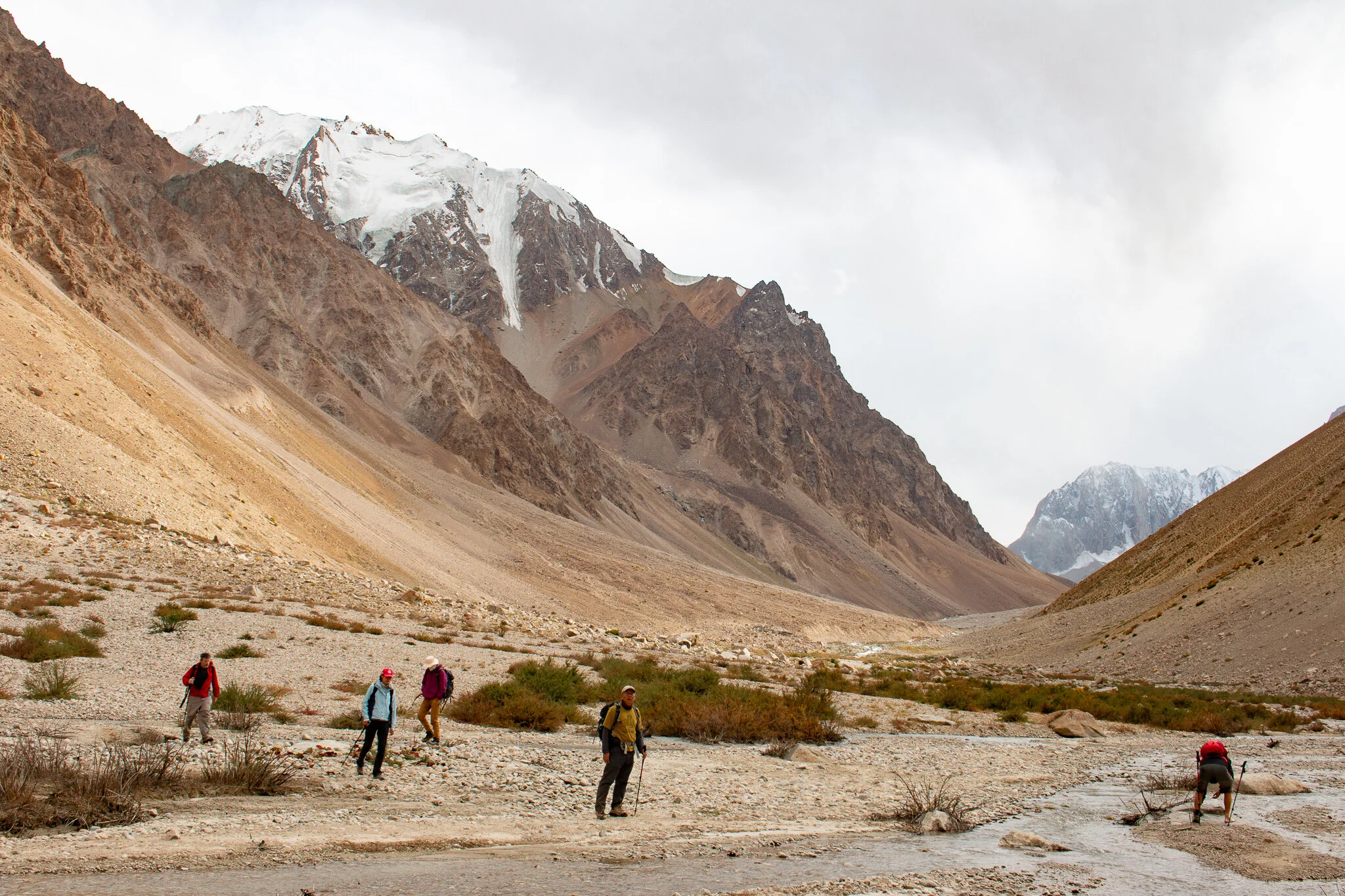
Crossing the Bardara River
It’s a special feeling to see friendly elements in the landscape again after having spent several days at high altitude. The first tree is solitary but stands proud next to the path and we can’t hide our big smiles. Gradually the valley becomes greener and we see the first signs of civilisation, agricultural patches of land and a small mudbrick hut. The last serious obstacle is a tributary that drains the glacial meltwater of the Turshedavi Glacier. It’s warm and the river has reached a critical level, just below its banks. Upstream we search for a safe place to cross but without success. We wait for our pack animals to arrive and hitch a ride across. The donkeys struggle to stay on their feet in the fast-flowing water, but we all manage to reach the other side dry. The final descent progresses quickly. The team is visibly motivated, breathing in the thicker air of Bardara. After nine days in the Pamiri mountain wilderness we collapse on the comfortable karputchas of our local homestay. No five-star hotel can beat this.