
An Explorer’s Account of Finding the Beob Pass
The crossing from the upper Zarafshon Valley to the Rasht Valley was, in historical times, quite easy. There was just the minor obstacle of the Pakshif-Ghorif Pass, which was open from late May to October. From Ghorif a traveler could venture straight downriver through the Ghorif Gorge to the Rasht Valley, then known as Qarotegin or Gharm. But, like many old historical routes, it relied on small bridges and “ovrings” (traversing cliffs with wood and rocks stacked up to create a flat trail). The explorer Willy Rickmers (1906) and the botanist Nikolai Vavilov (1916) both visited Ghorif and then went downriver with horses.
Now, over a century later it is not only impossible to go down the gorge with horses, but even just on foot. The locals say a very difficult climb up or down the gorge is possible by early October when the water drops low enough to walk in the river. Two French climbers made it up the gorge from the Rasht side on September 10-11, 2022, see here for their account. But they noted that the trip involved dangerous rock climbing sections on cliffs to avoid the river in multiple locations. It is not simply scrambling, but actually dangerous free solo climbing alternating with a very dangerous walk along a raging river where a single slip could lead to drowning.
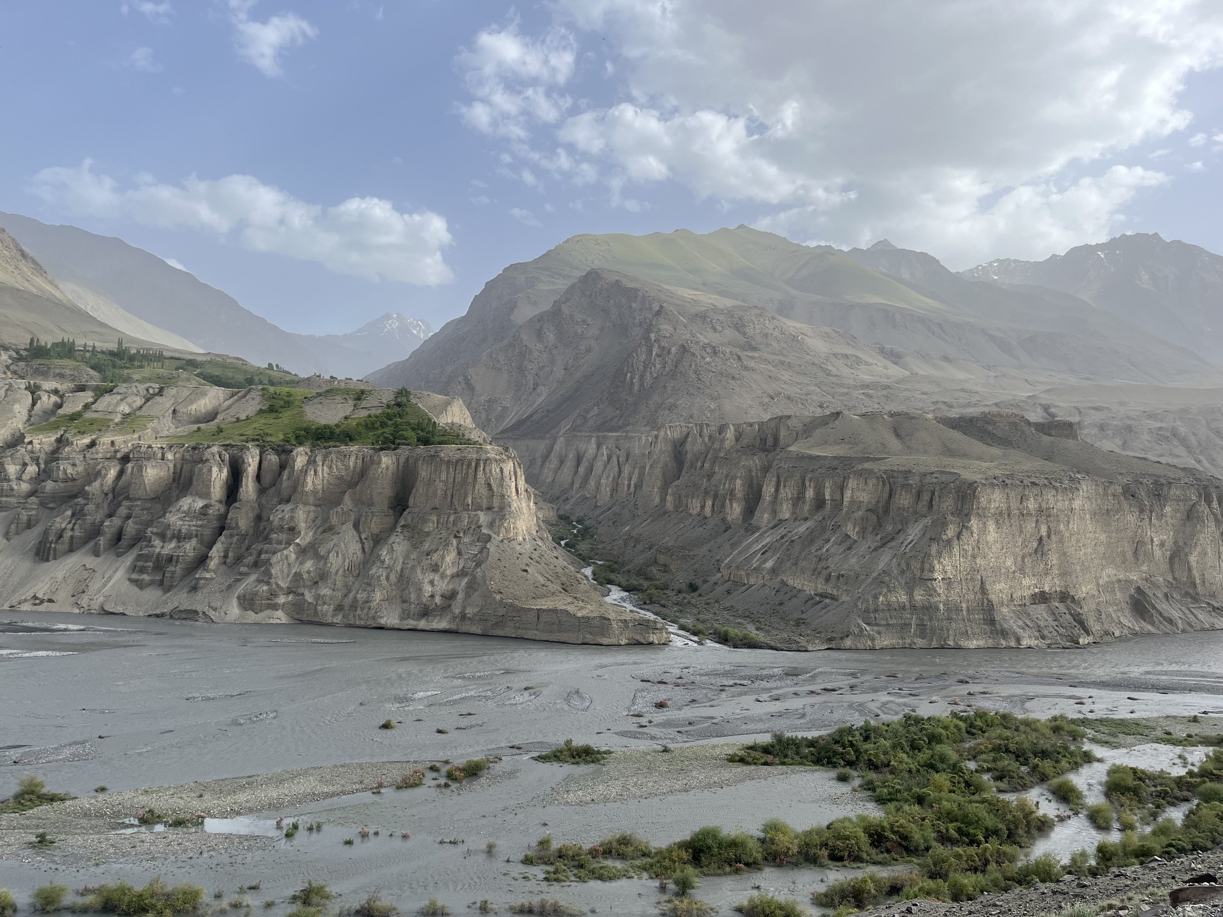
The mighty Zerafshan River, one of the sources of the Amu Darya river
The initial reasons for this route to be abandoned are not clear. It may be that a longer route around the mountains from Samarkand to Hisor to Gharm became easier for long distance travelers throughout the 19th century for a variety of reasons. Or perhaps the 19th century decline of the Kyrgyz in the Rasht Valley (who had earlier pushed into this area to graze their flocks, displacing the original Tajik and Eastern Iranian-speaking population) led to the route being left to fade.
The final and main blow to historical high routes in mountain areas in Tajikistan was twofold: Soviet roadbuilding that created faster and safer routes elsewhere, negating the need for high passes, and Soviet genocidal policies against mountain farmers and livestock herders. Assessing mountain agriculture and livestock as having no value to a modern industrial economy (and finding mountain people and nomads hard to control), Moscow deported mountain populations en masse to cotton plantations in the lowlands. Many died in the process of deportation and hard labor on collective farms, and the survivors’ memory of their mountain homeland began to fade. In their absence the trails faded, bridges collapsed, and knowledge of exact routes was lost.
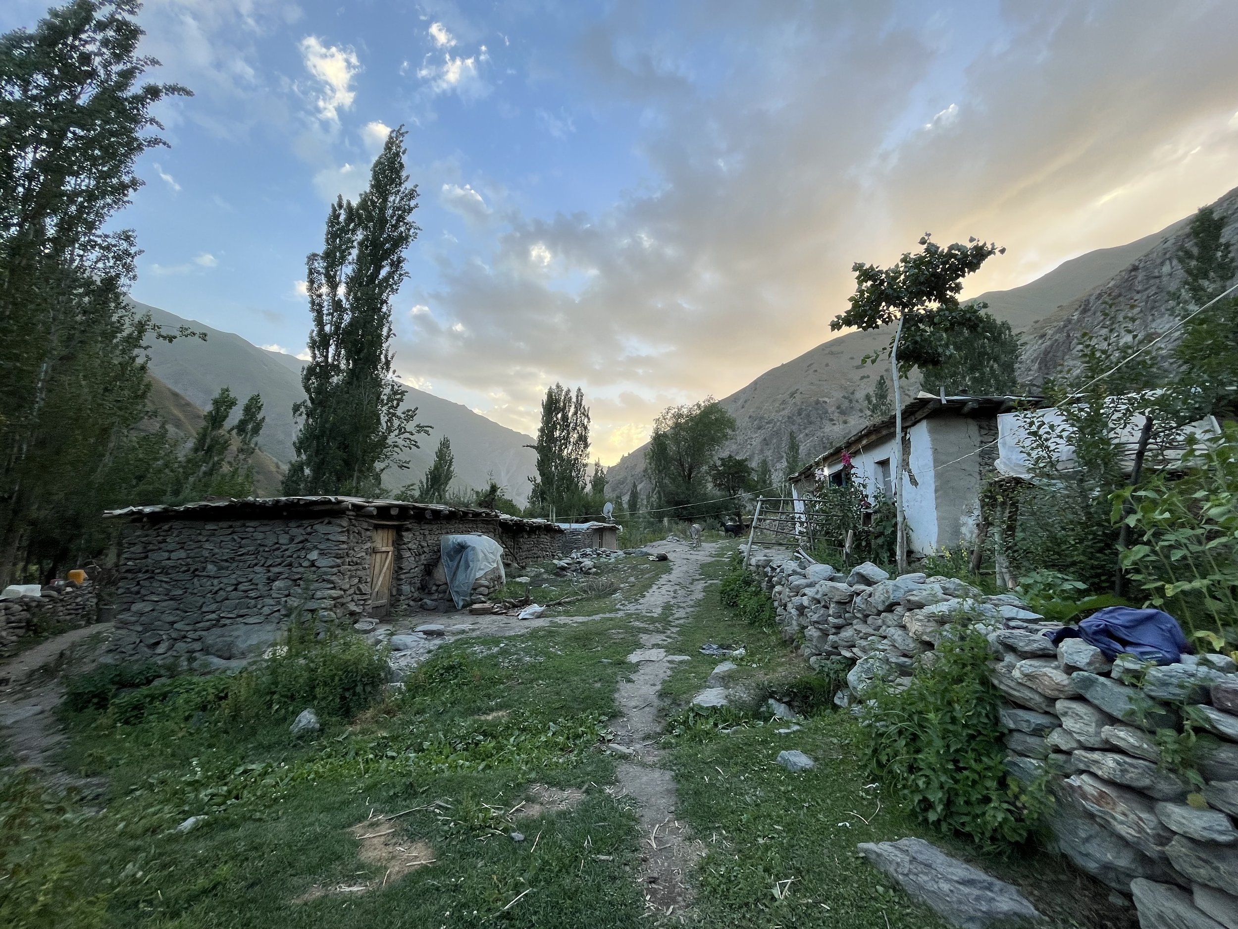
Ghorif, the most remote village in Tajikistan
By the 1970s and 1980s, Soviet policies became less restrictive and people were allowed to return to rebuild their mountain villages in this region. Overpopulation at collective farms played a part, as did a new Soviet economic directive to produce more meat - meaning the return of shepherds to mountain areas. While people on the lowland collective farms often suffered from malnutrition and poverty, the majority ethnic European and Russian population of Central Asian cities like Dushanbe and Tashkent had a much higher standard of living and demanded a steady supply of food from rural areas. This sent more and more shepherds to the high mountains. With the return of shepherds to the mountains came the rebuilding of trails and bridges.
When a Russian and Ukrainian climbing team descended to Ghorif from summiting a nearby peak in 1992, they expected to find an abandoned village, but instead found 4-5 families living there. However, Ghorif was the only village on the south side of Pakshif-Ghorif Pass to be repopulated - and at a lower population level than lived here before. Other villages like Namnarud and Khoja Nasrud, along with many other smaller villages, were never rebuilt. These villages remain as ghost towns, featuring small stone houses with collapsed roofs and abandoned farm fields and orchards gone wild. There are still many abandoned farm areas that were never revived. Bears eat the fruit and nuts in abandoned orchards, and cattle and sheep graze on fields that never returned to life. A good example can be found at the Dashti Rabot meadows upriver from Ghorif. The flat field here is lined by rocks that were removed for plow agriculture, and next to a spring lies an old millstone that once ground wheat into flour. This area is now home to cattle that graze the grass, but no more crops.
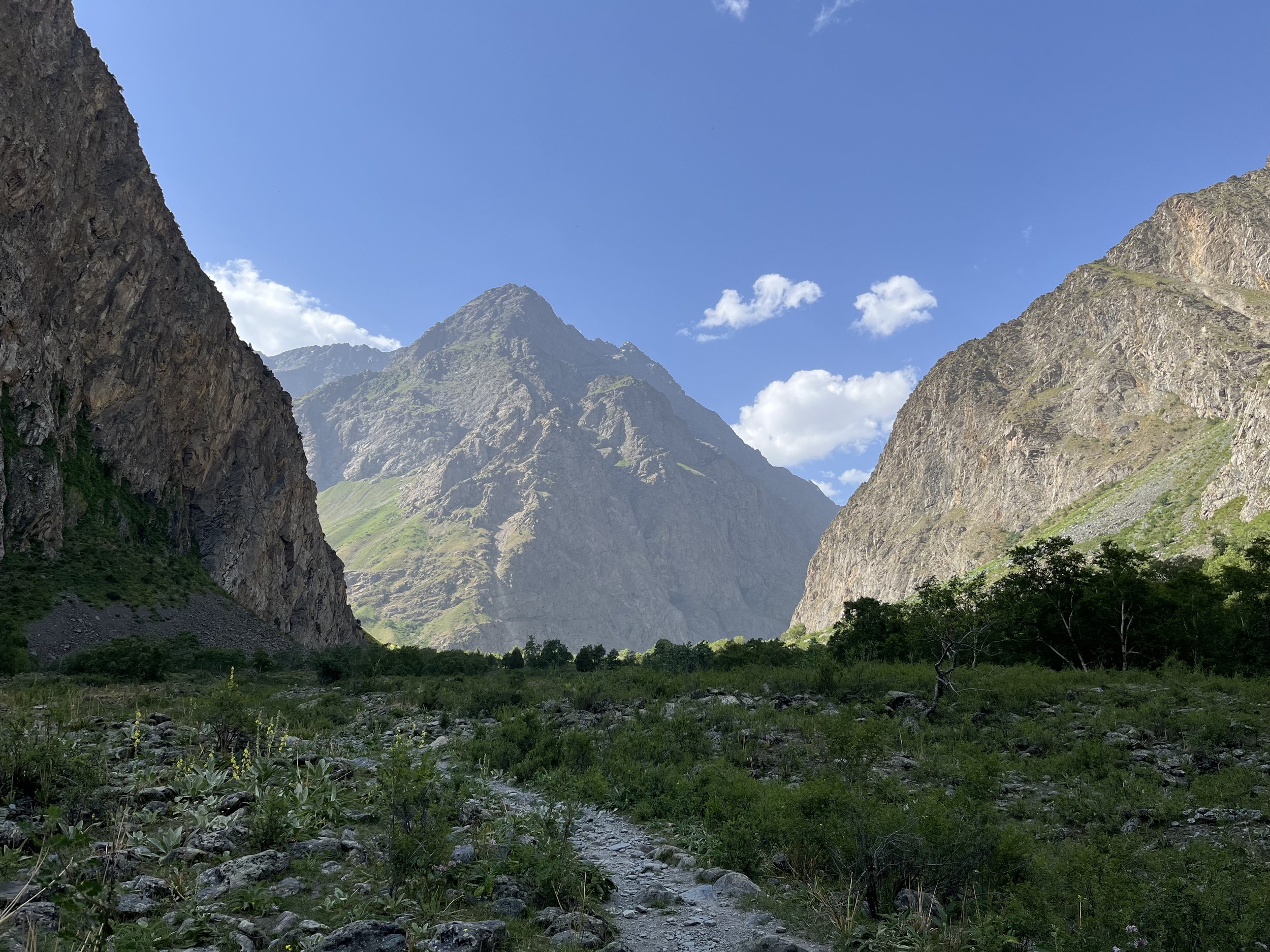
View from Ghorif to the north
Meat remains a product in Tajikistan that flows from rural areas where people rarely eat meat, to urban areas where the wealthier population enjoys a higher protein diet. The increasing concentration of wealth in Dushanbe and Khujand has pushed wealthy livestock owners to boost production by expanding grazing areas in the mountains, a process that involves new bridge building and the maintenance of trails. But the division of grazing area rights has created unconnected areas. Contract shepherds from the Zarafshon valley and elsewhere in northern Tajikistan bring their employers’ flocks through the Pakshif-Ghorif Pass and up the Namnarud Gorge. But they no longer connect over the ridge to the Rasht Valley side as they used to. And on the Rasht Valley side you will find contract shepherds who bring flocks all the way from southern Khatlon province. Nobody crosses the ridge anymore. Places like Khojai Muso Pass and Sari Jazira Pass are no longer used, and as a result are inaccessible to travelers.
There is no incentive for the wealthy livestock owners to build bridges and ovrings in the Ghorif Gorge, as that would not connect them to areas they have grazing rights for. And the smaller number of animals that are actually owned by locals (cattle, usually) graze the areas close by the villages and in dead-end gorges nearby. They have no incentive to build infrastructure as they don’t have the rights to graze the best grass above their villages.
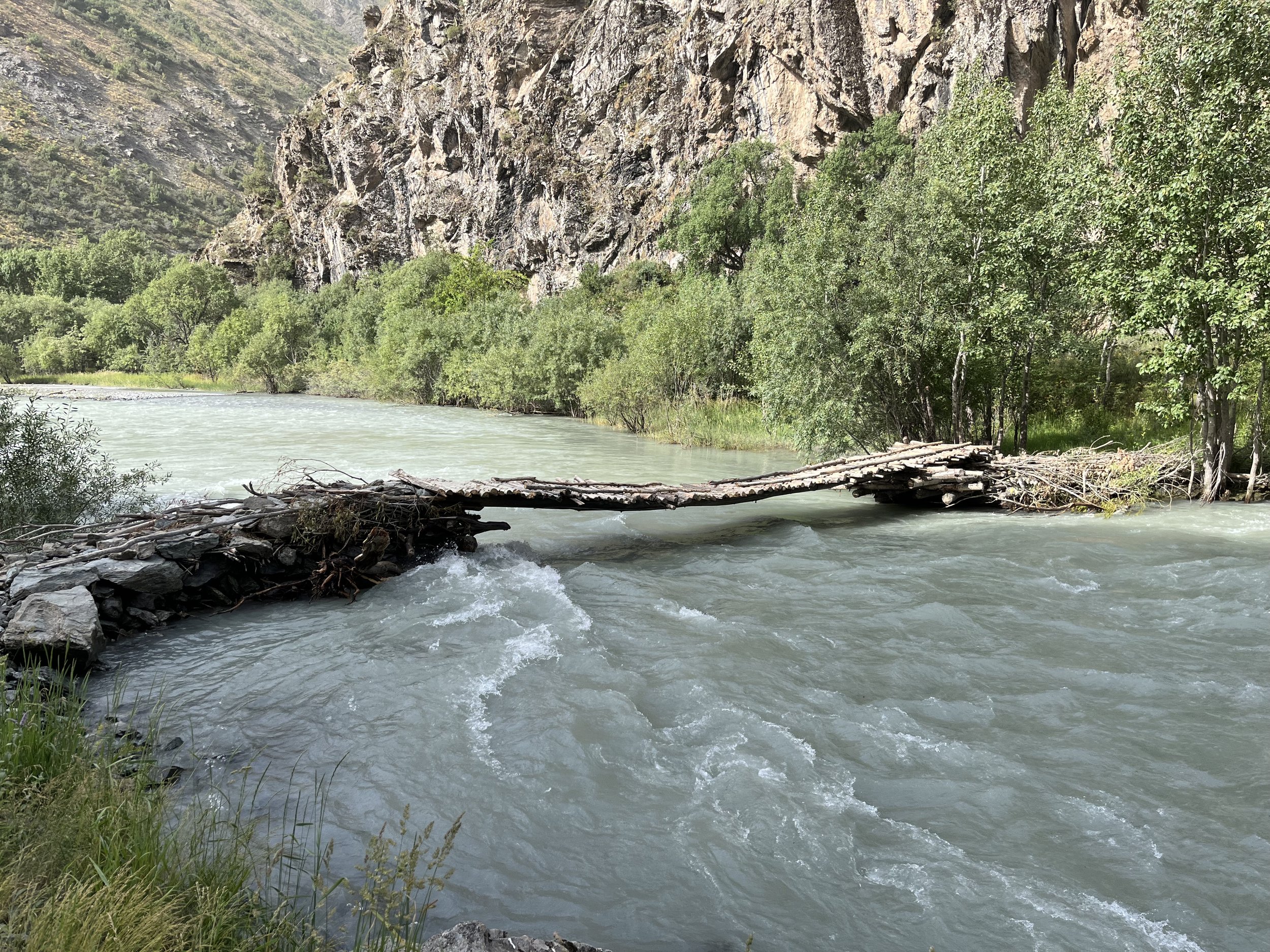
Bridge at the Puli Mirzo
A further complication has been the creation of international borders, leaving options such as the Khojai Muso Pass in restricted border zones. The result, for the mountain traveler wanting to travel between the upper Zarafshon valley and the Rasht Valley, is to go through a number of difficult mountain passes. After some investigation, it appears that the Beob Pass is the best option - confirmed by a 2023 visit to Ghorif when the locals said that was the best way to get to the Rasht Valley. However, as the head of Ghorif village stressed, the last group of travelers to go through that pass did so 40 years earlier in the 1970s.
A late July 2023 solo hike confirmed that Beob Pass is passable, but not without some difficulty. After the abandoned village of Namnarud there is no longer any sort of trail. The route is open terrain and, being in an area of Tajikistan with higher rainfall and limited grazing, the Beob Gorge is overgrown with a jungle of high weeds. At the top the gorge gets steep and steeper and you must navigate the boulders and rocks fields of old and new glacial moraines before a final sketchy ascent to the pass on glacier and a steep rock pitch.

Glacial lake at 3680m near the Beob Pass
Beyond Ghorif the terrain becomes wilder, with bear scat seen regularly and thorny brush pushing over the trail. After Ghorif I didn’t see another person until the Rasht Valley side on the third day of hiking. By the standards of western Tajikistan, this is quite an isolated and wild area. Anybody who hikes through this area will need a high degree of confidence to hike independently. Danger is always waiting with every river and bridge crossing, and the Beob Pass is not a certain thing. It may be an unpredictable scrambling on glacier and steep rock. Another danger is presented by the weather, with the ridges here getting hit regularly by storms and with much higher precipitation than the Fann Mountains or the Pamirs. A well planned selection of clothing and tent is required.
The people here are very friendly and hospitable and will engage with you in a way that they wouldn’t in the parts of Tajikistan that regularly see tourists. While hiking up the Ghorif Gorge a shepherd resupply caravaneer tried to convince me to hike back down to Pakshif to stay the night with his family. He settled for me taking a selection of tomatoes, cucumbers and bread from his resupply bags. Farther up the gorge two shepherds coming down suggested I go down with them and spend the night at their camp. After the pass I had shepherd resupply caravaneers stop to offer me advice and assistance. The sole shepherd camp on that side was manned by a solo shepherd who also offered a place for the night in his large shepherd tent. In Ghorif I was greeted by several people and a larger number of curious children. I was shown to their new guesthouse and given a mattress, blankets and dinner. I ended the hike near Navobod where I had to turn down multiple offers of free accommodation in people’s homes.

Looking north from the Beob Pass (4030m), the crux pass of the PT’s section 4!
This area is the best option for connecting a thru-hike of Tajikistan. However, it will never become a popular tourist destination. The area is just too isolated, the hiking too difficult, and there is a lack of any single major attraction. There is no huge turquoise blue alpine lake, nor is there a massive glacial icefall that you can walk up to. The area is instead full of subtle beauty: a birch forest of the type you can only see on one other location in Tajikistan, a gorge overgrown with a jungle that elsewhere would have been deforested long ago if next to a road, a small mountain village emerging from destruction (Ghorif), and alpine grasslands and flowers that you won’t find in the drier or overgrazed parts of Tajikistan.

View of the Darai Mazor River