
Formidable Barriers

Jump for joy! The background is the spectacular Darvoz Range. Photo: Michael Wissmann
The Pamir Mountains are one of the least visited mountain ranges on the planet. Certain sub-ranges are not even visited by its own inhabitants, the shepherds, anymore. A team of intrepid trekkers ventured this summer to the northern Pamirs to research a route connection for the first long-distance hiking trail in Central Asia, the Pamir Trail. The trail starts close to the border with Uzbekistan in the west of Tajikistan and terminates in the far south, the Wakhan Corridor. The intended route between the Rasht Valley and the Vanj Valley across the wild Darvoz Range is still a blank on the map, with no obvious trails or other vital infrastructure. It is a haven for endangered wildlife, such as the Markhor sheep and the elusive snow leopard.
The Rasht Valley has seen turbulent times in recent history. In the 1990’s it was the epicenter of the civil war that tore Tajikistan apart and cost according to the most conservative estimations at least 50,000 lives. These days it’s relatively quiet, especially in the valley we are headed for, the Obikhingob Valley. It’s a dead-end with a terrible road that connects it with the rest of the country. The aim of the recce expedition is to find an attractive and hikeable route across this wild part of the Pamirs.
The suspension bridge sways as we walk across, with the furious Obikhingob River underneath us. The river drains the meltwater of some of the largest glaciers in the Pamirs and it’s at its maximum volume. The left bank is lush and covered with alpine flowers. Big glaciated peaks poke out behind the green slopes. Except for a few farm houses there is no sign of human habitation. Since this area was declared a national park, shepherds have been barred from herding their livestock on the hillsides of the Darvoz Range. The deeper we head into the valley, the harder it gets to find the trail. It’s late and after a steep overgrown gully we decide to call it a day and pitch our tents on a flat but overgrown little plateau overlooking the spectacular valley.

Crossing the wild Obikhingob River. Photo: Derek Hardwick
Erosion is the biggest threat to the existing trail network in the Pamirs. Every winter avalanches wipe away trail sections. In spring time heavy rains saturate the soil and cause big landslides. Our first natural barrier is a steep river bank, without a trail. The bank has essentially broken off, leaving highly unstable ground for us to cross. It’s a proper no-fall zone. One mistake on the more than 50 degrees slope and you’ll end up in the fast-flowing river, 20 metres below. The heavy packs we’re carrying add to the difficulty of the tricky traverse. One by one we tread the instable passage. Lino, one of our team members, slips and slides down and scrambles with everything he has to stop his fall. Miraculously he manages to stall and find his way to the other side. Everybody has gone a little quiet, thinking what challenges may lie ahead of us.

The Bijou Valley, a natural barrier we weren’t able to tackle, this time. Photo: Michael Wissmann
Just 2 kilometres further we do find our ultimate challenge: a milky-brown torrent called the Bijou River. It’s wedged in a narrow valley and drains the meltwater of two large glaciers, the Bijou and Nusoyak glaciers. Wading through is not an option and we can’t find a bridge. Along with our support team we follow a vague trail on the steep river bank, in search of a solid snow bridge to cross to the other side. We spot a small one and decide to look further. A few hundred metres upstream we see another one. Two of our support team descend to the river to assess it, but most of us are not sure. There is a massive crack visible and if the snow bridge collapse it means certain death. Munir, our cook, is already on the other side and states it’s fine to cross. Mmm… Kim and Arthur head down to assess the bridge their way. Kim drops a 5kg rock on the edge of the snow bridge, causing roughly 8 square metres to break off. That’s a definite no. Even if we would make it across, there is a possibility we have to turn back the same way. What does this bridge look like in 5 days, if it’s still there at all? Deflated and disappointed we gaze at the river. It’s a formidable barrier, even more of a barrier than the towering peaks that surround us. We set up camp on the bank of the Obikhingou, and decide just to explore the valley higher up the next day.

A makeshift bridge, too risky to cross with a 20kg pack. Photo: Kim van der Leeuw
From a distance, the terrain in the Bijou Valley doesn’t look easy. From up close, the true left of the valley is near to impossible. Treacherous gullies, thick vegetation and areas of potential rock fall make this a very undesirable route choice for the Pamir Trail. At least we know now, which is worth something. On our way back to our camp Yun, our Tajik guide, spots a structure. A wooden ladder is attached to a big rock with some cables. It’s angled and again the team members are looking at each other. Is this safe enough, especially carrying large heavy packs? Even some of our local guys express their doubt, which is for us enough to vote against the crossing. The Bijou River is, for now, our Waterloo.
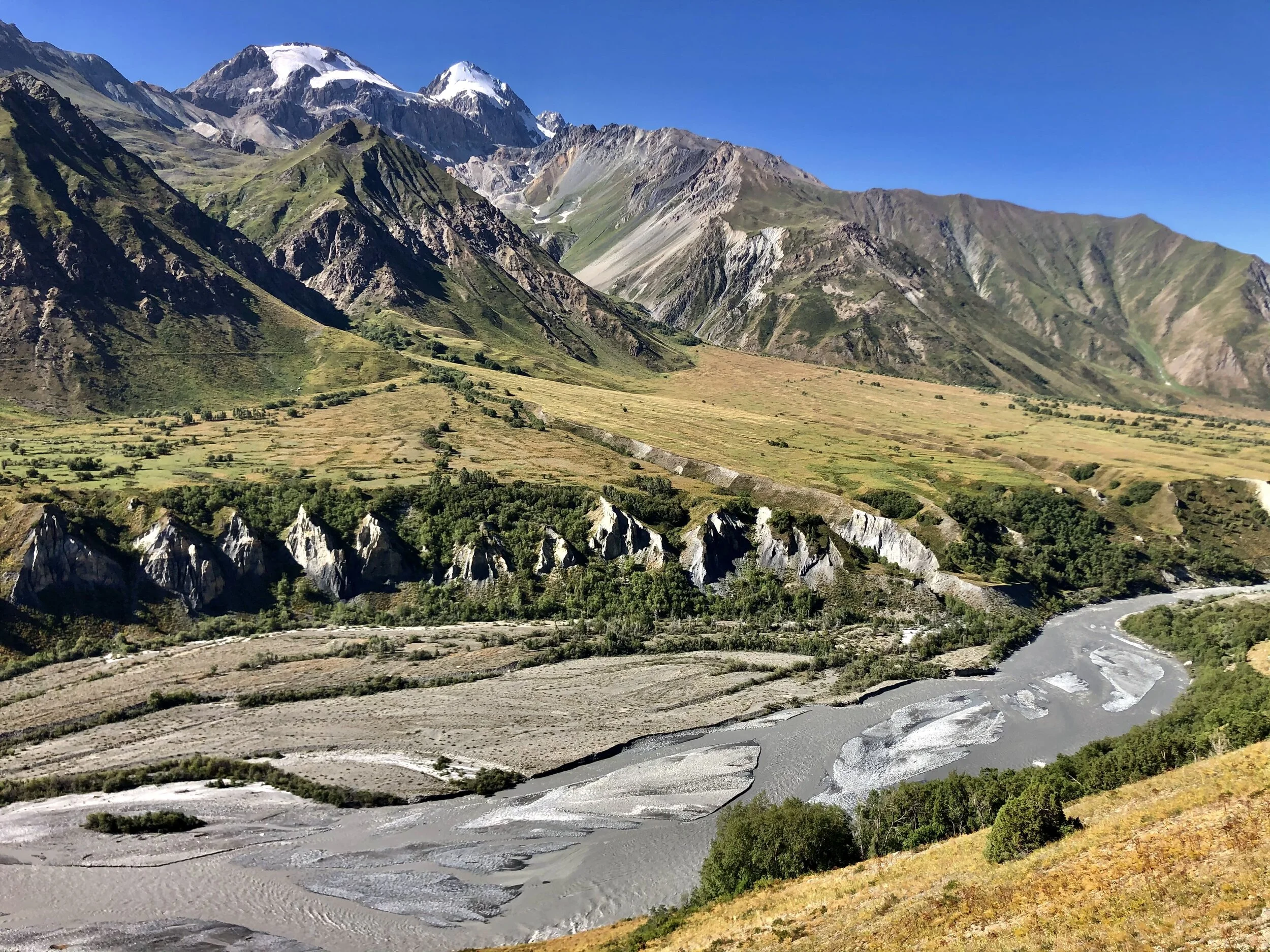
The Obikhingob Valley, seen from the north. Photo: Jan Bakker
The team switches mindset and we reset our aims. Along the way we observed the mountains across the Obikhingob, called the Peter the Great Range. It’s the northern most sub-range of the Pamirs and the peaks are tall, close to 6000 metres. Even the south-facing summits are plastered with glaciers. The approach to the valleys seems doable. We plan to set up a camp near the last village in the valley, Arzing. This is an excellent base to explore the far end of the valley called Pashmighar, an abandoned settlement, where three major rivers come together to form the Obikhingob. But first we head straight up, to the terminus of an enormous hanging glacier. The mountain itself does not have a name on the maps we are using, despite the fact it’s 5200 metres high. It’s an idyllic valley, with crystal clear streams and a sea of flowers. The high summits are a first ascent paradise for mountaineers. As we get higher we look back to an incredible panorama of the snowcapped peaks of the Darvoz Range. It’s a sawtooth ridge and looks intimidating. Somewhere between these ice giants is a pass that may allow us to the other side, the Vanj Valley. Perhaps next year.

Our perfect basecamp near the village of Arzing. Photo: Jan Bakker
We created a short film about this epic expedition, see here. Thank you Paramount Journey for the great logistical support on this expedition. For those who are interested in a trekking trip in Tajikistan, please visit their website to learn about the options: www.paramountjourney.com.

The Pamir Dream Team, post-expedition

See you again in 2022! Photo: Kim van der Leeuw