THE PAMIR TRAIL
Shing - Vrang * 1313km * download full trail * highest point Vrang Pass 5010m
The trail info on this page is subject to change and will be updated regularly. Ultimately it should provide detailed trail information, including practicalities (transport, accommodation, guiding services) and maps with lots of geographical names and features. For this, we use the app Outdoor Active.
-WARNING: TREKKERS ATTEMPTING TO HIKE THE PAMIR TRAIL DO THIS AT THEIR OWN RISK. MOUNTAIN TERRAIN AND WEATHER CHANGE ALL THE TIME AND TREKKERS SHOULD BE PREPARED FOR THE WORST CONDITIONS. IF IN DOUBT, TURN BACK IF YOU CAN. THE CREATORS OF THE PAMIR TRAIL TAKE NO RESPONSIBILITY FOR ANY DAMAGE, INJURY, LOSS OR DEATH-
THE PAMIR TRAIL
Start and end: Shing - Vrang
Distance: 1313 km
Elevation gain: 61,056 m
Stages: 79
Video of the full length of the Pamir Trail in 3D
In 2024 we established the first full version of the Pamir Trail! This means it is possible to hike the entire length the route, 1313 kilometres in total with an elevation gain of 61,056 metres. But we keep looking for alternative routes, as the state of the terrain changes all the time. The current complete version of the Pamir Trail is featured in the video below. This fantastic edit gives you a sense of the mountain ranges the trail passes across Tajikistan. It shows the 9 different sections of the route. The Pamir Trail map above shows the complete route with each section by colour code.
SECTION 1: FANN MOUNTAINS
Shing - Saratoq * 158.5km * download stage descriptions * highest point Chimtarga Pass 4750m * trail beta stage 1-11
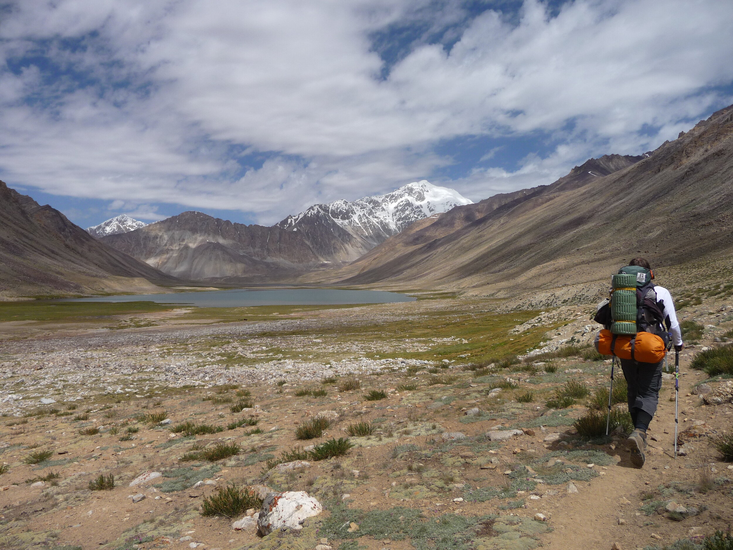
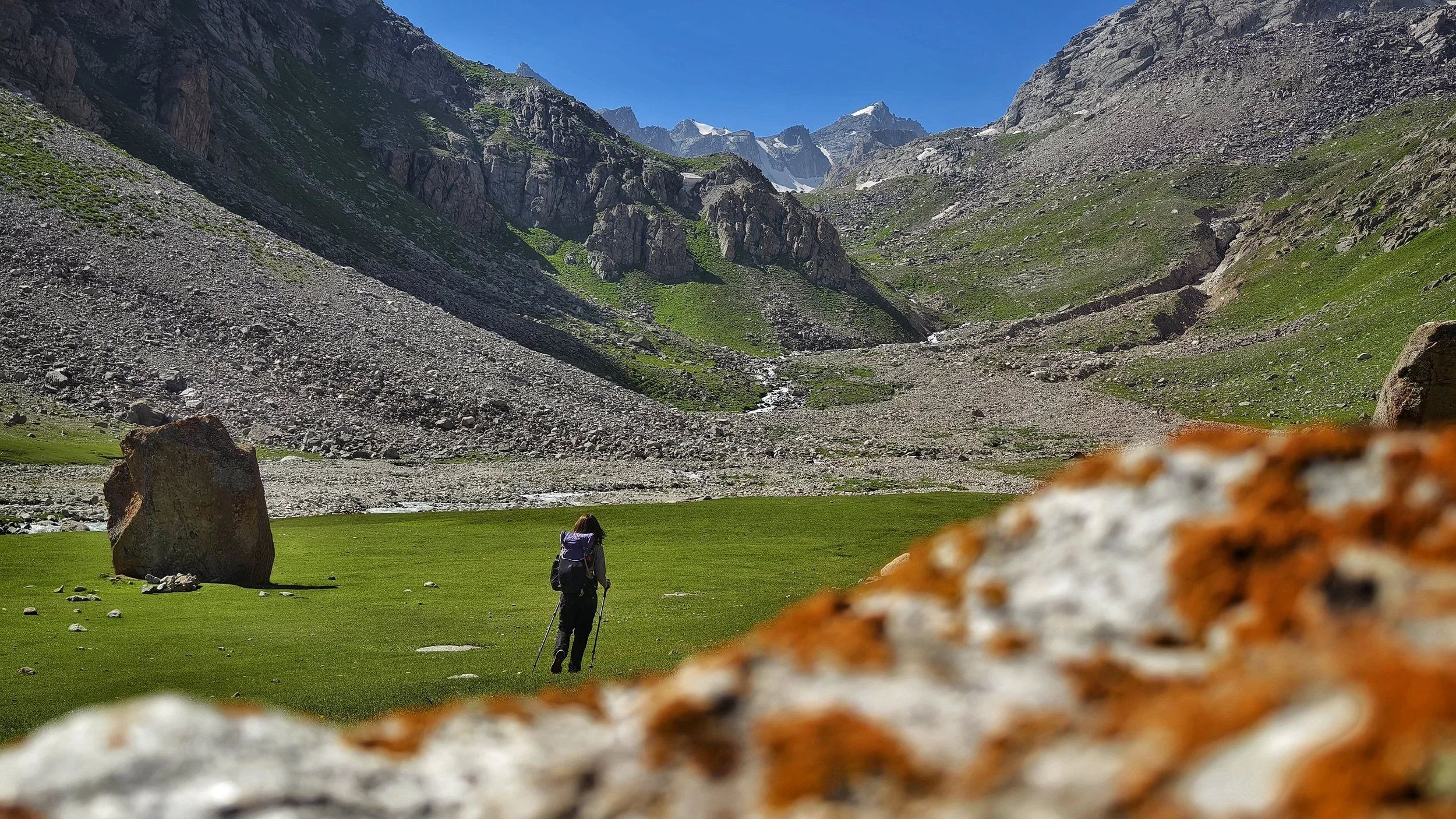
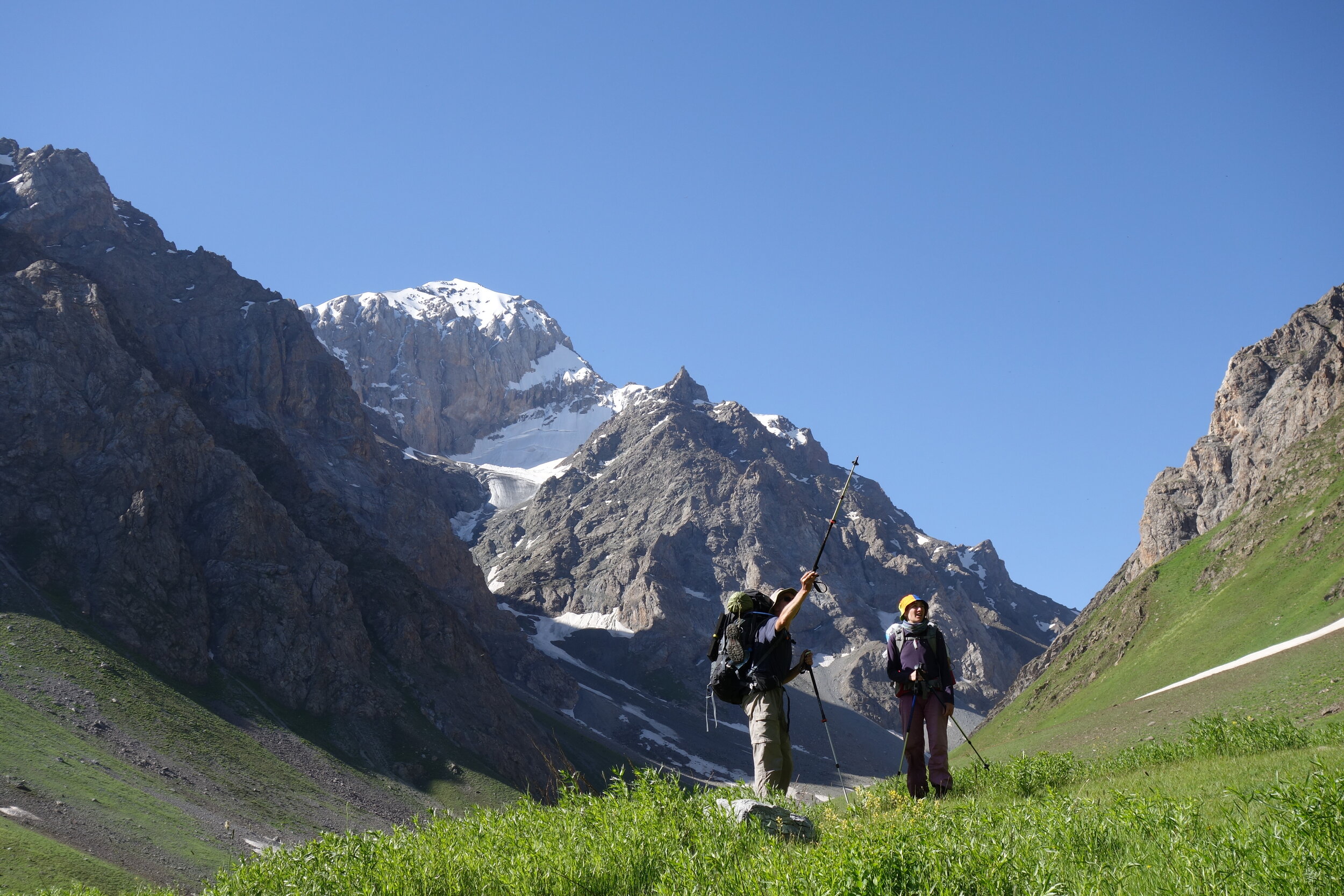
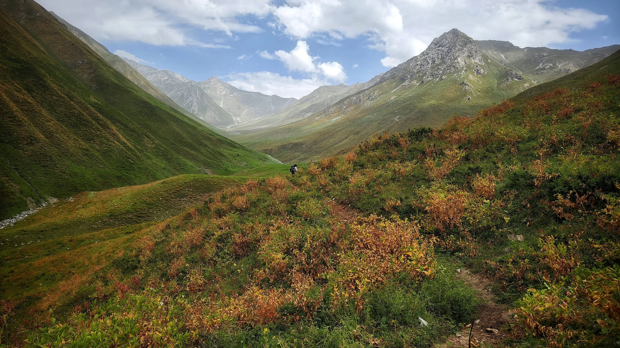
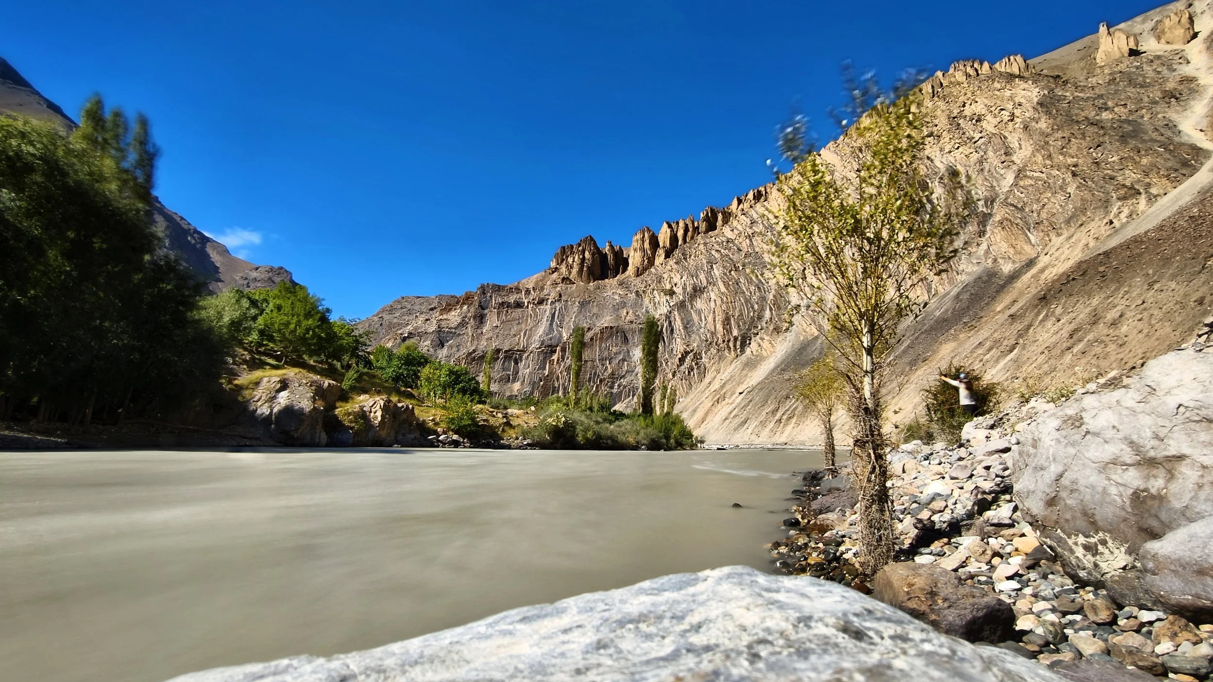
Haftkul Valley - pic: M. Hrda
Stage 1: Shing - Padrud
Distance: 16.1km
Ascent: 766m
Descent: 322m
Trail: easy - dirt road
Descent from the Tovasang Pass - pic: M. Merisi
Stage 2: Padrud - Tovasang
Distance: 22.9km
Ascent: 1853m
Descent: 1354m
Trail: hard - dirt road and clear trail
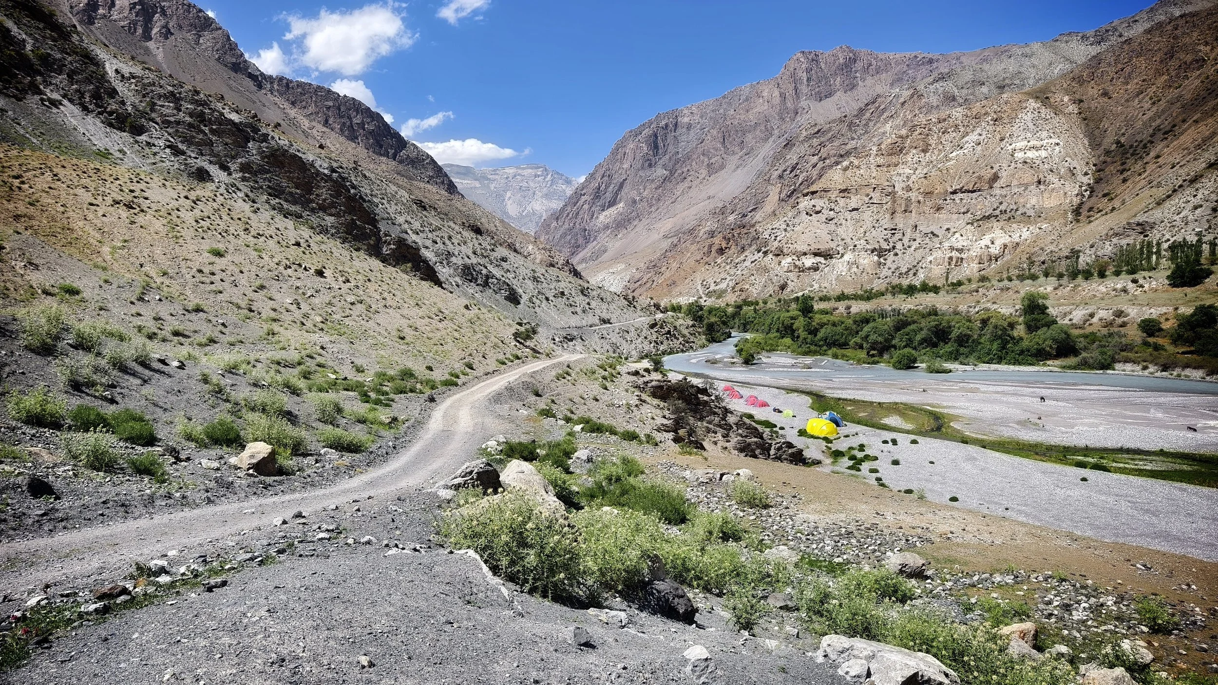
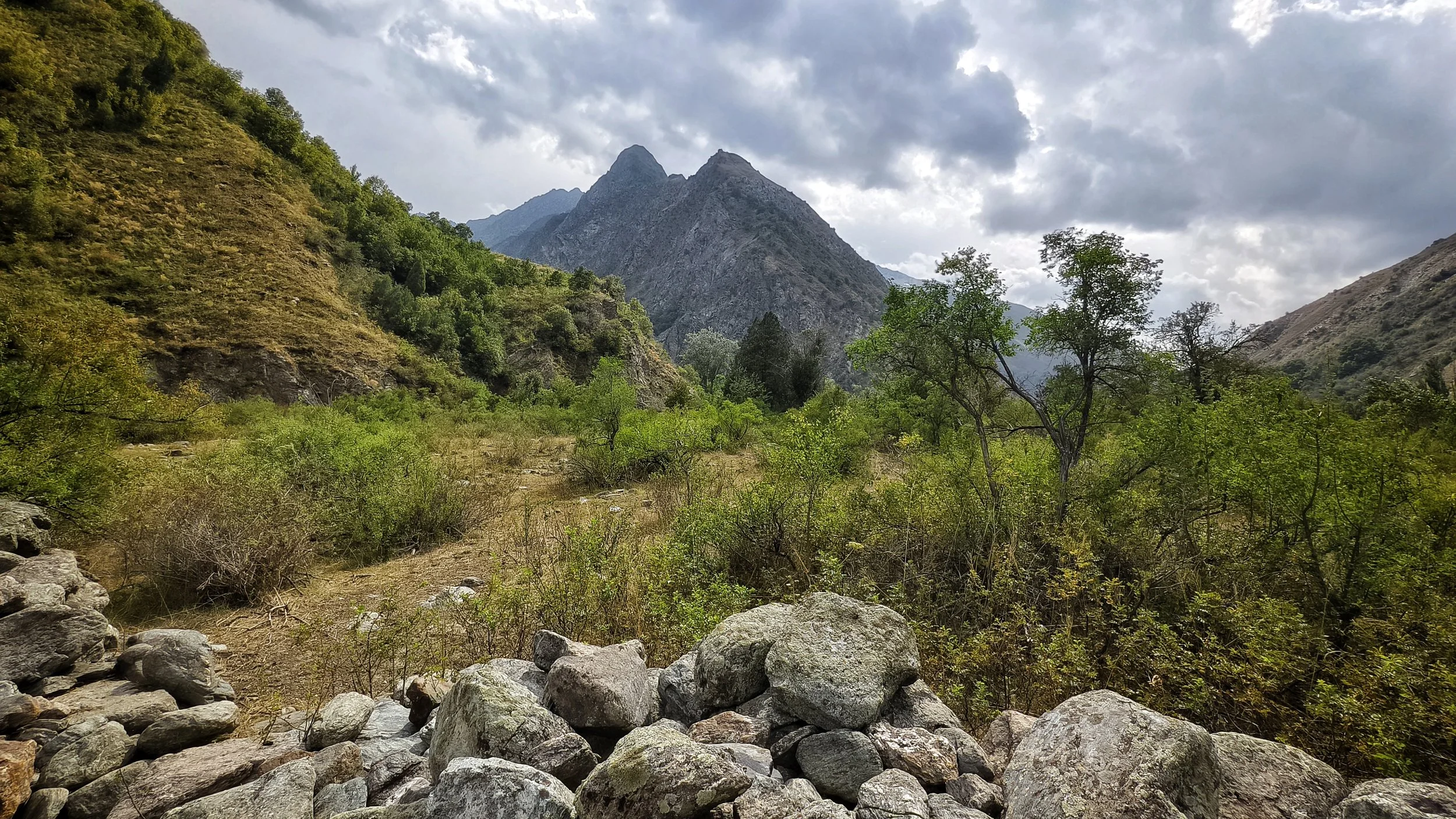
Looking into the Archamaydon Valley - pic M. Hrda
Stage 3: Tovasang - Zimtud
Distance: 21.9km
Ascent: 371m
Descent: 1121m
Trail: easy/moderate - dirt road and clear trail

Magical Chuqurak Lake - pic: M. Merisi
Stage 4: Zimtud - Camp Artuch
Distance: 13.7km
Ascent: 1239m
Descent: 619m
Trail: easy/moderate - dirt road and clear trail
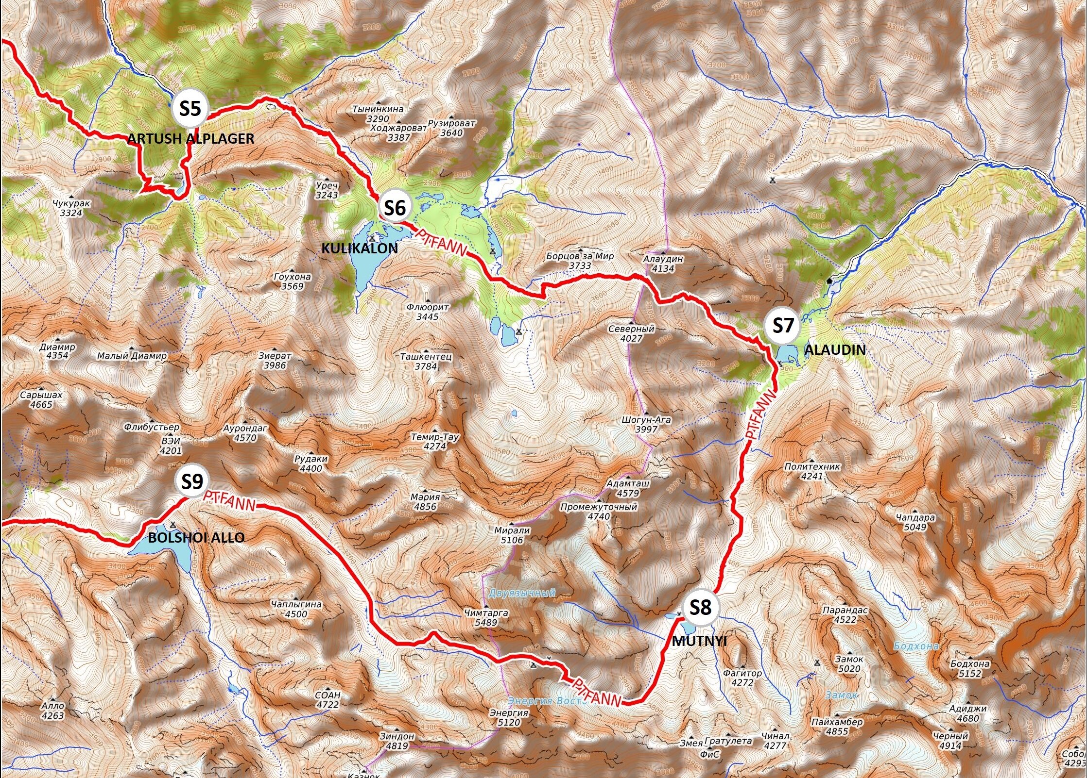
Dramatic approach to Kuli Kalon - pic: M. Merisi
Stage 5: Camp Artuch - Kuli Kalon
Distance: 4.9km
Ascent: 690m
Descent: 20m
Trail: moderate - clear trail

The upper lake of the Alauddin Lakes - pic: J. Bakker
Stage 6: Kuli Kalon - Alauddin
Distance: 10.2km
Ascent: 954m
Descent: 989m
Trail: hard - clear and faded trails

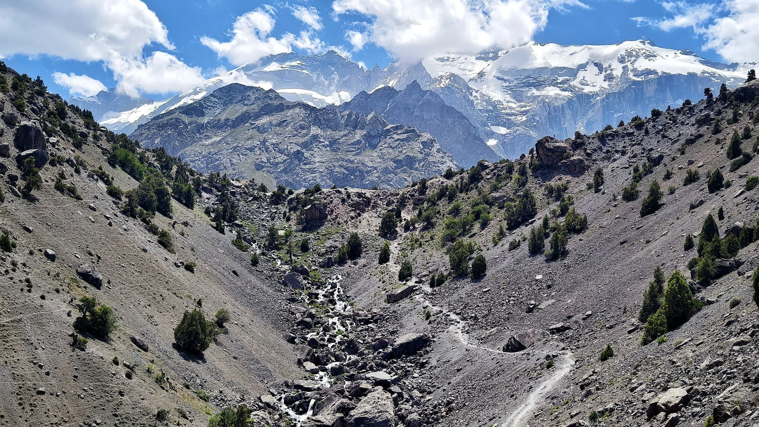
The summit of Chimatarga, 5489m - pic: J. Bakker
Stage 7: Alauddin - Mutnyi
Distance: 5.1km
Ascent: 708m
Descent: 4m
Trail: easy - clear trails

The top of Chimatarga Pass at 4750m pic: C. Oriol
Stage 8: Mutnyi - Buzurg Alo
Distance: 13.2km
Ascent: 1227m
Descent: 1568m
Trail: hard - clear and faded trails
Buzurg Alo - pic: M. Merisi
Stage 9: Buzurg Alo - Archamaydon
Distance: 13.2km
Ascent: 137m
Descent: 1449m
Trail: moderate - dirt road and clear/faded trails
The stunning Archamaydon Valley - pic: M. Hrda
Stage 10: Archamaydon - Dugdon
Distance: 18.2km
Ascent: 1347m
Descent: 213m
Trail: moderate - mostly clear trails

The top of Dugdon Pass at 3810m - pic: C. Oriol
Stage 11: Dugdon - Saratoq
Distance: 20.8km
Ascent: 839m
Descent: 1439m
Trail: moderate/hard - clear and rough trails

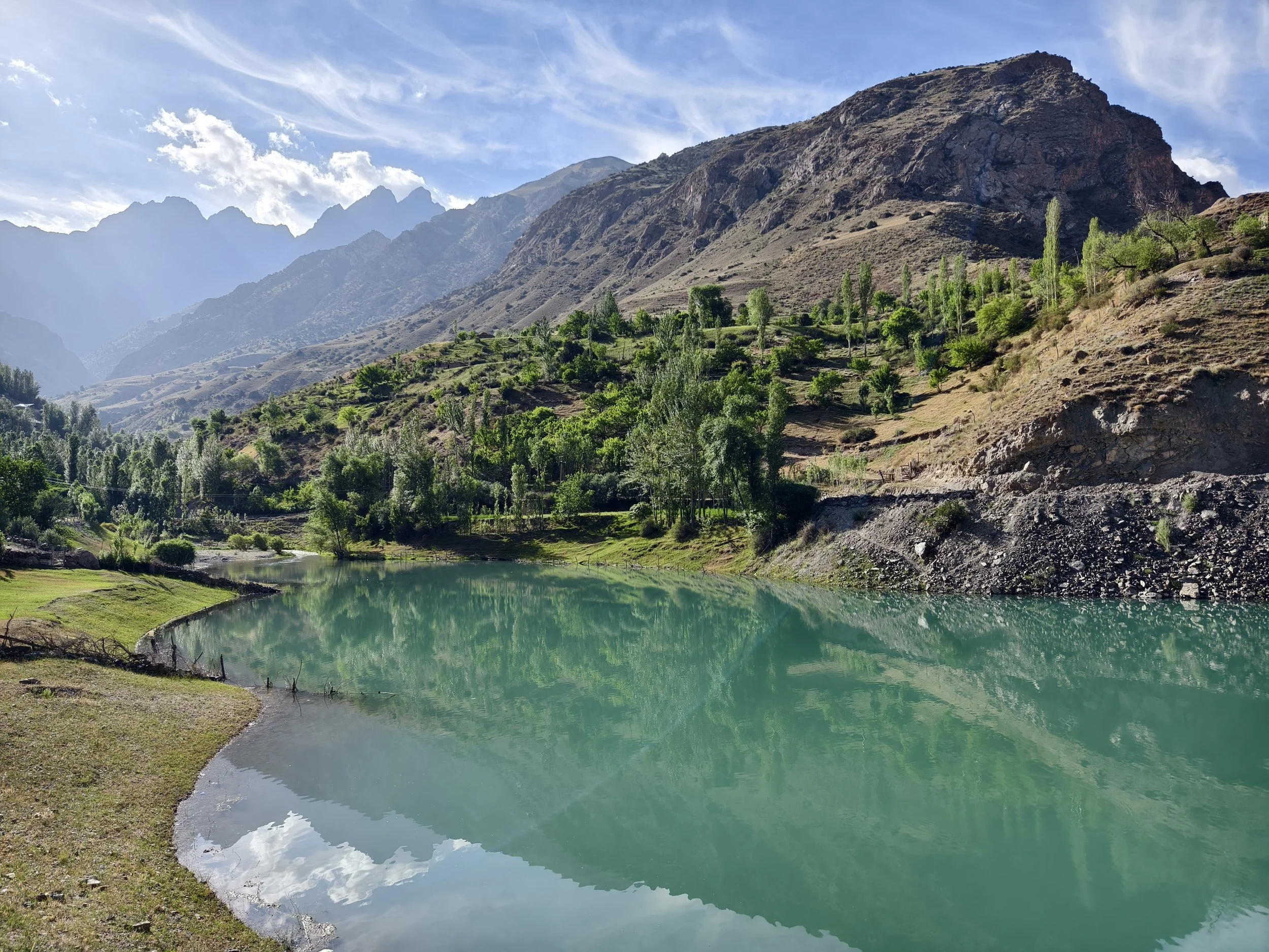
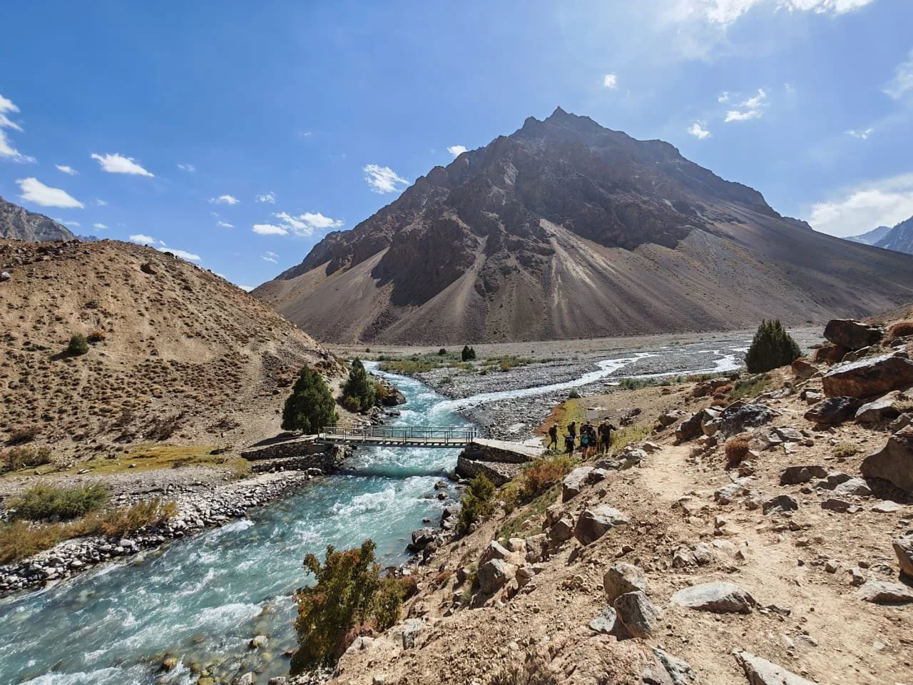
Iskandarkul - pic: Eurasia.travel
Side trip: Saratoq - Iskandarkul
Distance: 11.4km return
Ascent: 332m
Descent: 332m
Trail: easy - dirt road and clear path
SECTION 2: HISOR TRAVERSE
Iskandarkul - Margheb * 178km * download stage descriptions * highest point Aghai Qul Pass 3851m *
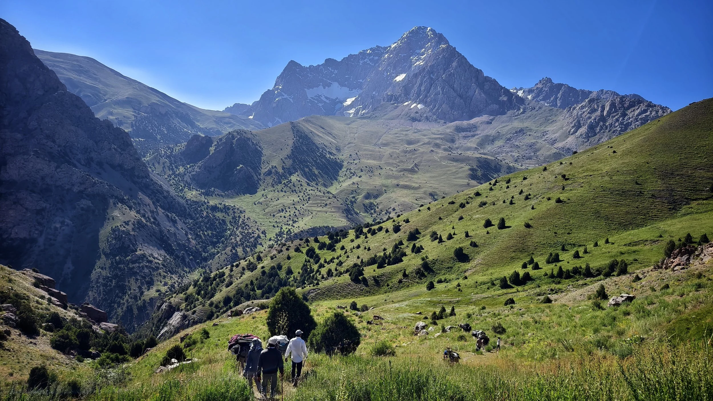
Lush meadows towards Mura/Zombar - pic:M. Merisi
Stage 12: Saratoq - Zombar
Distance: 12.1km
Ascent: 793m
Descent: 131m
Trail: moderate - dirt track and mostly clear trails
Top of Mura/Zombar Pass at 3780m - pic: M. Merisi
Stage 13: Zombar - Qaratogh
Distance: 13.7km
Ascent: 765m
Descent: 1683m
Trail: hard - clear and rough/no trails
Qaratogh Valley - pic: M. Merisi
Stage 14: Qaratogh - Payron
Distance: 17.7km
Ascent: 1042m
Descent: 461m
Trail: easy/moderate - clear path, some exposure

View of Payron Valley from Khonaqo - pic: J. Bakker
Stage 15: Payron - Khonaqo
Distance: 11.3km
Ascent: 1170m
Descent: 645m
Trail: hard - vague or no trails across pass

The Khonaqo Valley is spiky! - pic: J. Bakker
Stage 16: Khonaqo - Luchob
Distance: 12.1km
Ascent: 863m
Descent: 1986m
Trail: moderate/hard - clear and rough/no trails

Semi-wild horses on the Luchob pass - pic: J. Bakker
Stage 17: Luchob - Khoja Obi Garm
Distance: 17.3km
Ascent: 736m
Descent: 959m
Trail: easy - clear path

Crossing the Darai Kulol River - pic: J. Bakker
Stage 18: Khoja Obi Garm - Darai Kulol
Distance: 11km
Ascent: 440m
Descent: 537m
Trail: easy/moderate - road and clear/rough trails

The upper Darai Kulol Valley - pic: J. Bakker
Stage 19: Darai Kulol - Soghdiana
Distance: 10.9km
Ascent: 1601m
Descent: 500m
Trail: hard - rough steep and vague trails
Descent from the Dushokha Pass - pic: M. Merisi
Stage 20: Soghdiana - Ganjdara
Distance: 11.5km
Ascent: 1328m
Descent: 1217m
Trail: very hard - rough, steep trails and no trails

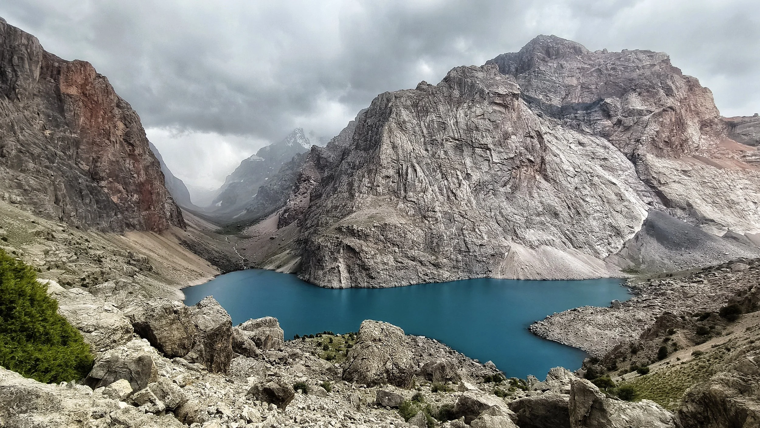
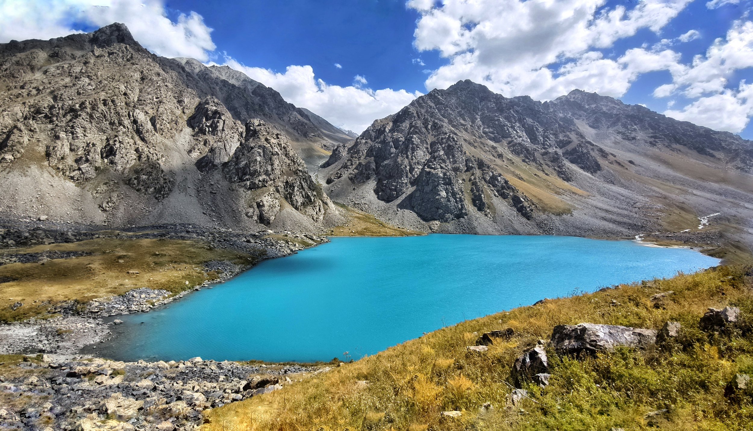
Lolakul Lakes - pic: C. Oriol
Stage 21: Ganjdara - Lolakul
Distance: 18.3km
Ascent: 1159m
Descent: 757m
Trail: moderate - clear and some vague trails
The Tagobiqul Valley - pic: C. Oriol
Stage 22: Lolakul - Tagobiqul
Distance: 18.2km
Ascent: 559m
Descent: 1367m
Trail: moderate/hard - snow fields and variable trail

Sheep shearing near Qul Pass - pic: J. Bakker
Stage 23: Tagobiqul - Tagrich
Distance: 13.1km
Ascent: 1142m
Descent: 696m
Trail: easy/moderate - clear trail

Chilling out on the Tagrich Pass - pic: J. Bakker
Stage 24: Tagrich - Margheb
Distance: 14.5km
Ascent: 802m
Descent: 1554m
Trail: easy - clear trails and dirt track
SECTION 3: YAGHNOB AND ZARAFSHON
Margheb - Langar * 120km * download stage descriptions * highest point Ghuzn Pass 4020m * trail beta stage 25-31

The north side of Zamin Qaror - pic: J. Bakker
Stage 25: Margheb - Bidev
Distance: 20.5km
Ascent: 698m
Descent: 479m
Trail: easy - dirt track and clear trail

Abandoned Niva, Piskon village - pic: J. Bakker
Stage 26: Bidev - Piskon
Distance: 13.5km
Ascent: 713m
Descent: 591m
Trail: moderate - dirt track and clear trail
The glorious Yaghnob Valley- pic: M. Merisi
Stage 27: Piskon - Novobod
Distance: 21.9km
Ascent: 880m
Descent: 831m
Trail: moderate - variable trails

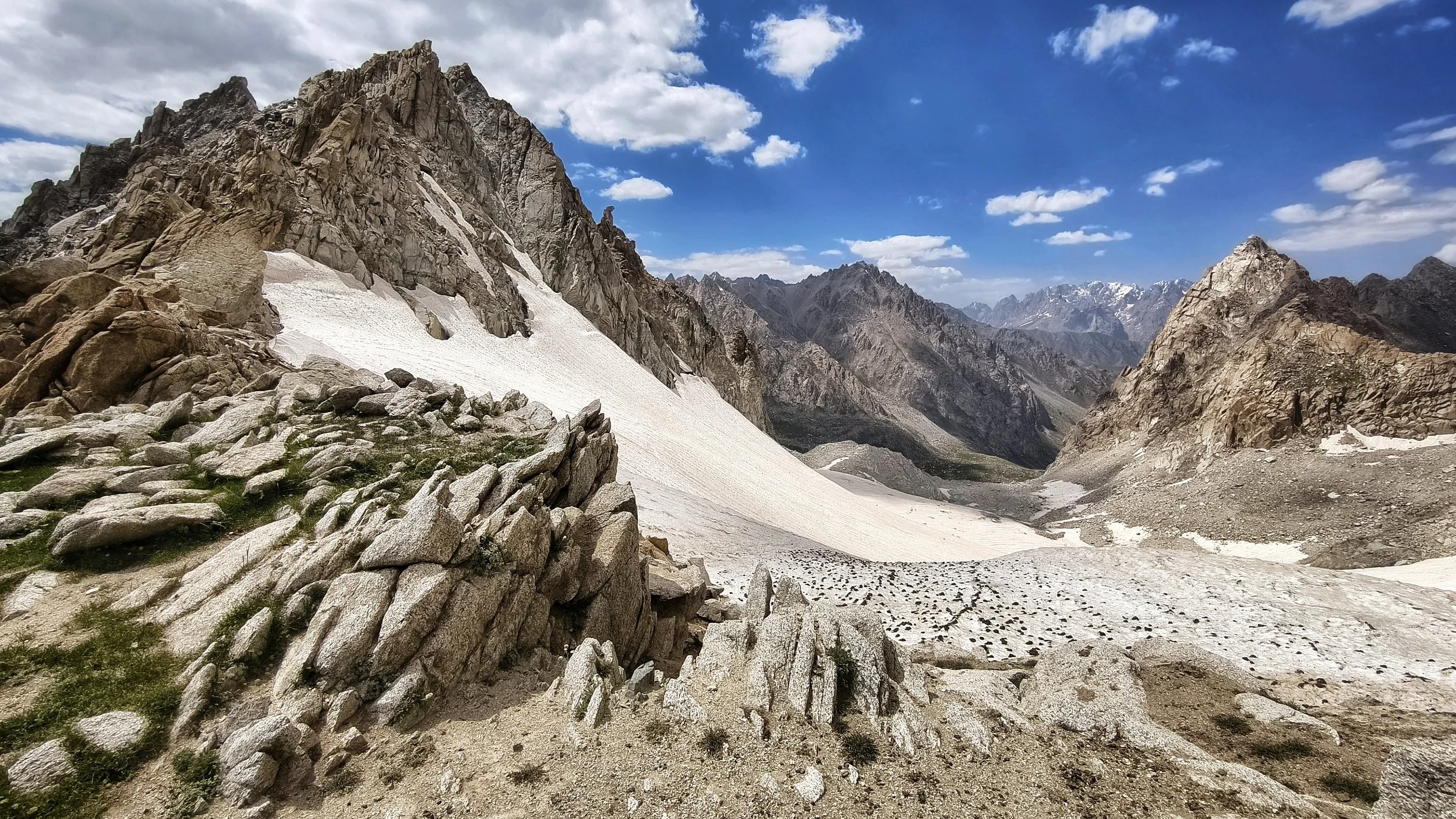
A glacier on the Ghuzn Pass
Stage 28: Novobod - Jayi Bolo
Distance: 11.2km
Ascent: 1479m
Descent: 1056m
Trail: hard - rough and no trails

On top of a 3885m Pass to Revut
Stage 29: Jayi Bolo - Marghashak
Distance: 18.2km
Ascent: 891m
Descent: 885m
Trail: easy/moderate - clear track and trail

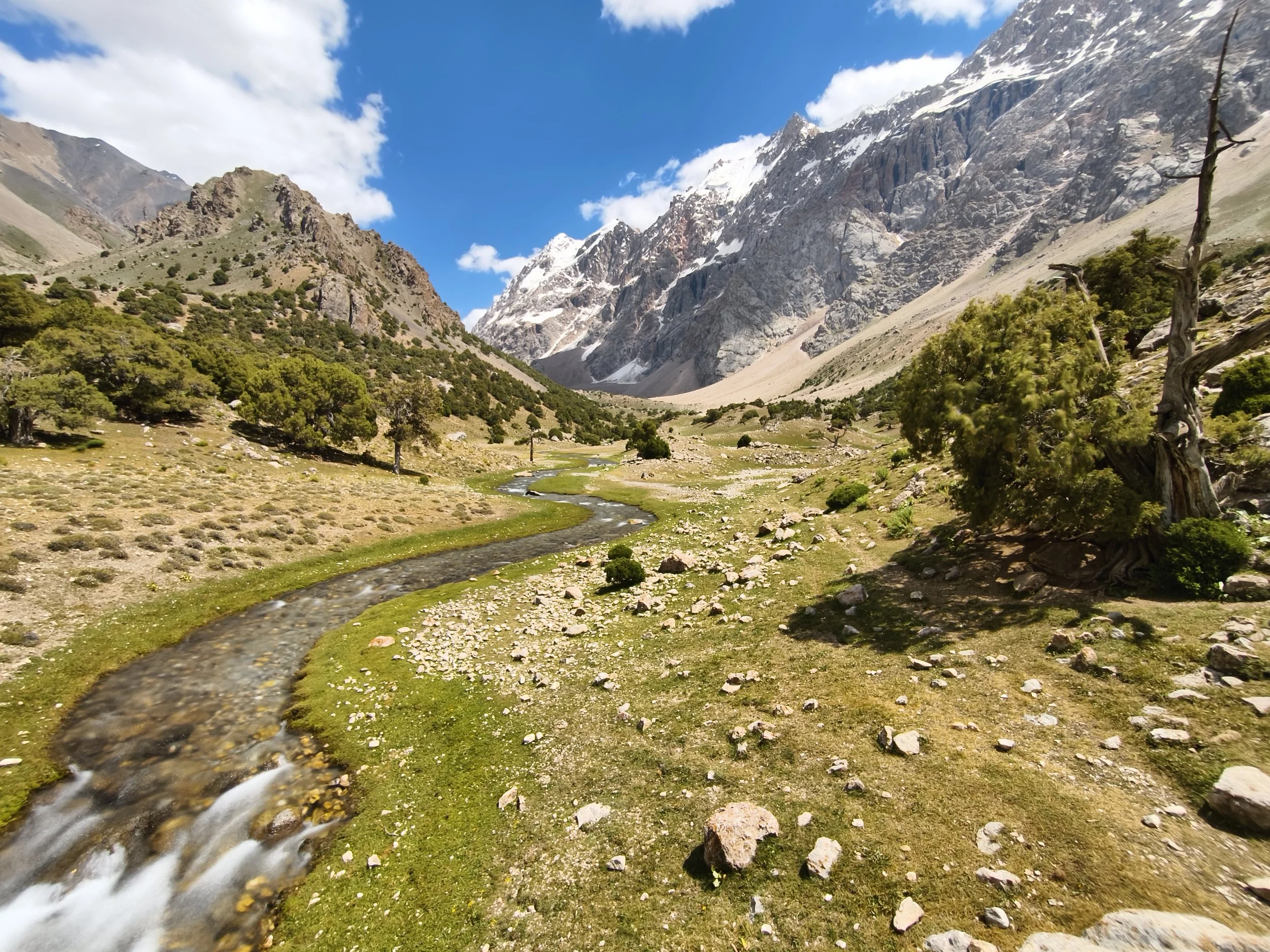
The upper part of the Revut Valley
Stage 30: Marghashak - Revut
Distance: 14.5km
Ascent: 843m
Descent: 1425m
Trail: moderate - variable trails

The lower Revut Valley
Stage 31: Revut - Langar
Distance: 21.8km
Ascent: 366m
Descent: 739m
Trail: easy - clear track and trail
SECTION 4: UPPER ZARAFSHON AND RASHT
Langar - Dehai Hojiali * 121km * download stage descriptions * highest point Beob Pass 4030m * trail beta stage 32-28

The Zarafshon Valley
Stage 32: Langar - Pakshif
Distance: 36.2km
Ascent: 827m
Descent: 519m
Trail: easy - track and clear trails
Pakshif Gorge
Stage 33: Pakshif - Pakshif Gorge
Distance: 9km
Ascent: 588m
Descent: 33m
Trail: easy/moderate - clear trail
View from the Pakshif - Ghorif Pass - pic: M. Hrda
Stage 34: Pakshif Gorge - Ghorif
Distance: 17.2km
Ascent: 756m
Descent: 1613m
Trail: moderate - clear and vague trails
Namnarud ruins - pic: M. Merisi
Stage 35: Ghorif - Namnarud
Distance: 8.1km
Ascent: 193m
Descent: 275m
Trail: hard - vague overgrown trails
Looking north from Beob Pass - pic: M. Hrda
Stage 36: Namnarud - Beob
Distance: 12.5km
Ascent: 2001m
Descent: 572m
Trail: very hard - no trail, overgrown terrain

The descent to Navobod - pic: M. Merisi
Stage 37: Beob - Navobod
Distance: 21.9km
Ascent: 237m
Descent: 2434m
Trail: moderate - clear and vague trails, track
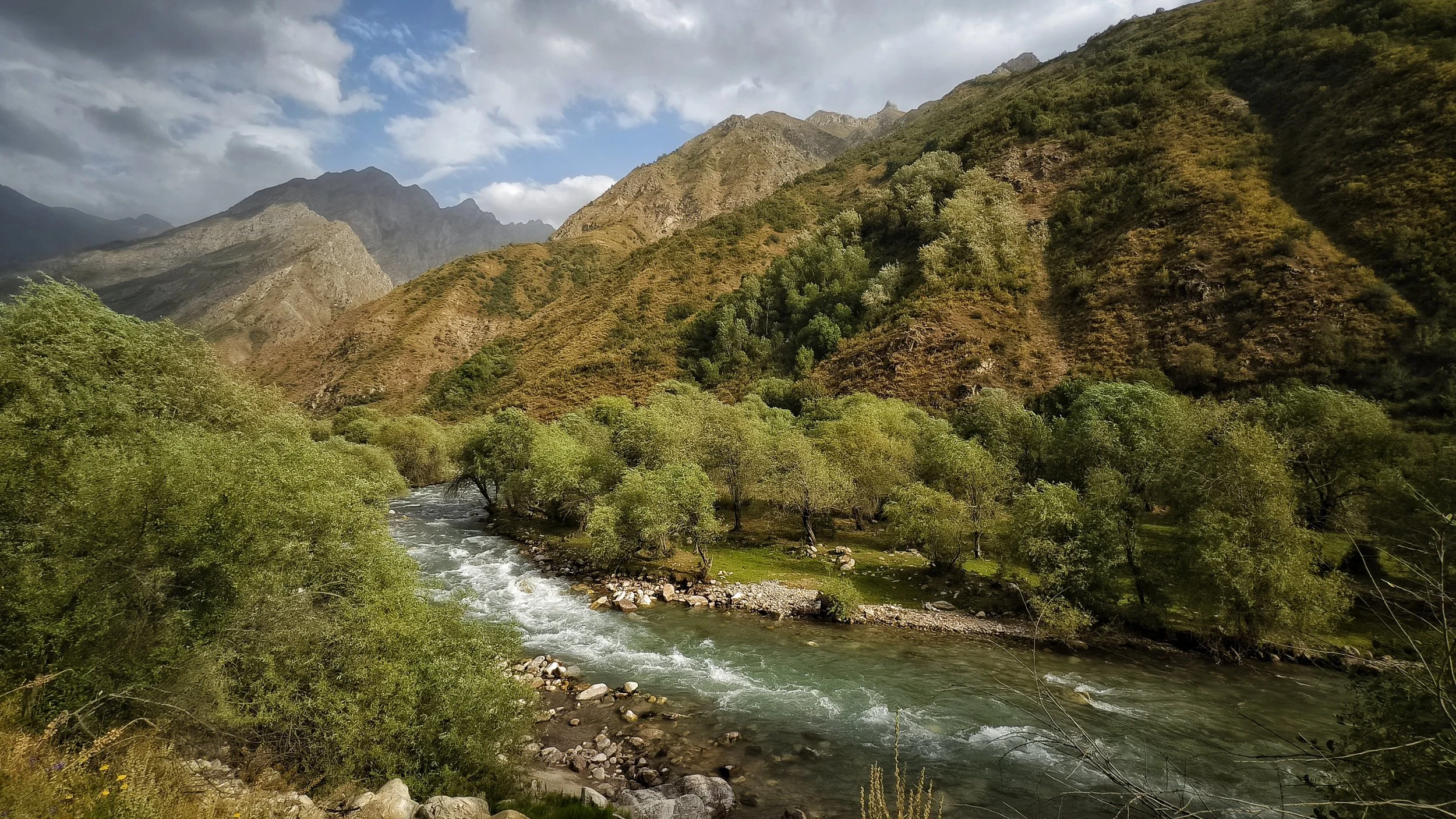
Sorbogh River - M. Merisi
Stage 38: Navobod - Hojiali
Distance: 16.6km
Ascent: 153m
Descent: 104m
Trail: easy - Dirt track and minor road
SECTION 5: QAROTEGIN TRAVERSE
Dehai Hojiali - Vahdat (Jirgatol) * 109km * download stage descriptions * highest point Pildon Pass 3654m * trail beta stage 39-44
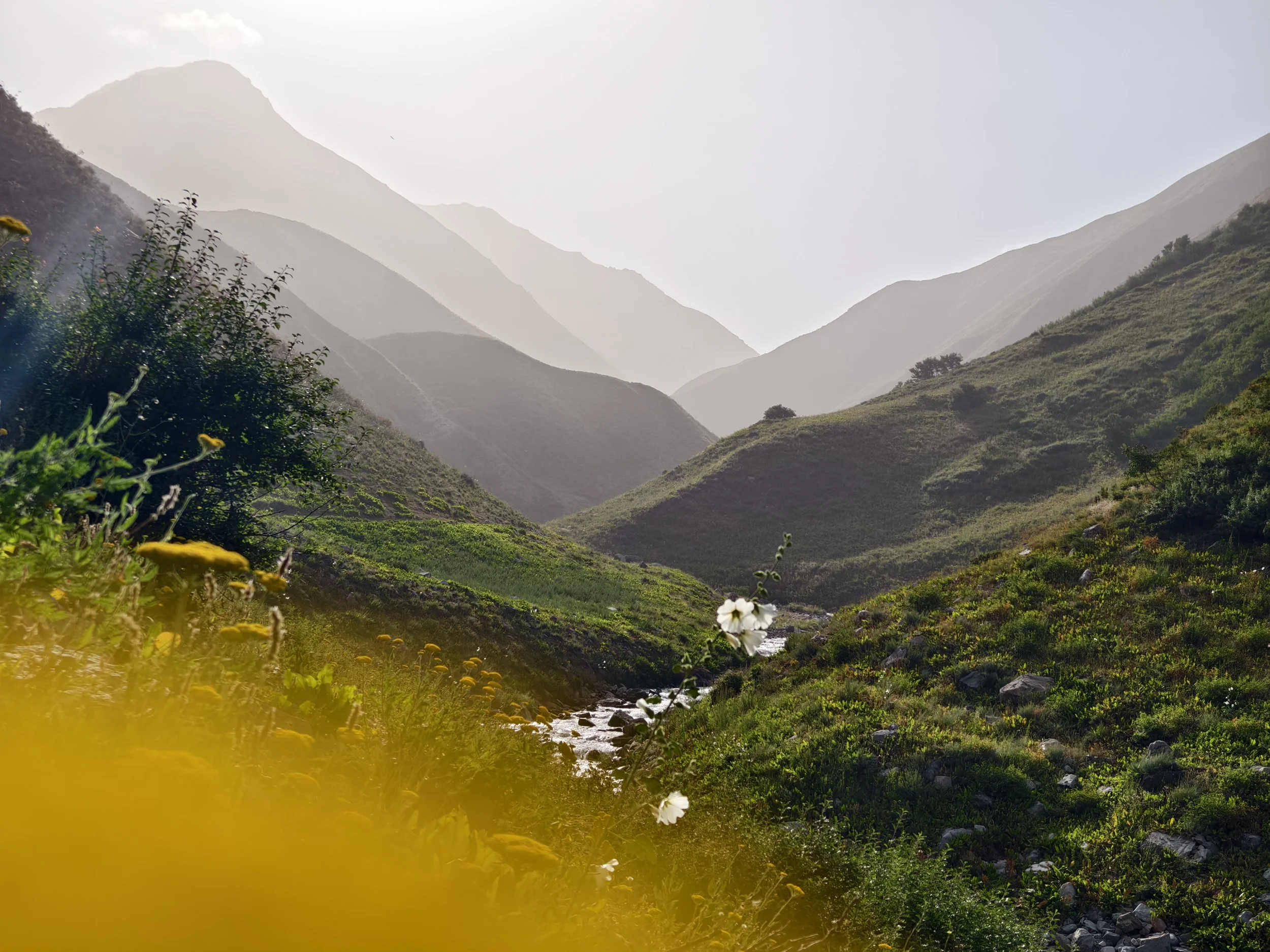
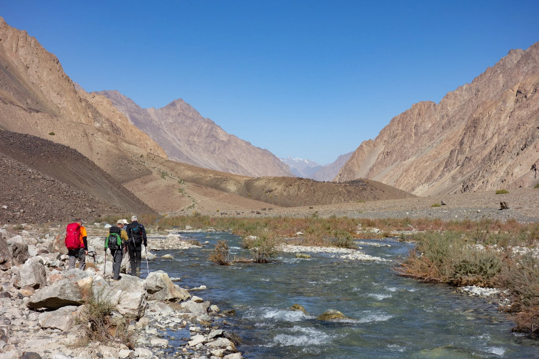
The Kamarob Valley - pic: M. Hrda
Stage 39: Hojiali - Subotrud
Distance: 24km
Ascent: 665m
Descent: 20m
Trail: easy - clear track
Approach to the Dashtikhirsun Pass - pic: M. Merisi
Stage 40: Subotrud - Hazorchashma
Distance: 10.8km
Ascent: 993m
Descent: 103m
Trail: easy/moderate - clear to vague trail

View from the Dashtikhirsun Pass - pic: J. Bigé
Stage 41: Hazorchashma - Safedob
Distance: 18.5km
Ascent: 604m
Descent: 1436m
Trail: moderate/hard - variable to no trails

A bridge near Hoit - pic: J. Bigé
Stage 42: Safedob - Kulikalon
Distance: 21.9km
Ascent: 584m
Descent: 474m
Trail: easy - clear track

High plateau around Pildon Jailoo - pic: J. Bigé
Stage 43: Kulikalon - Pildon
Distance: 14km
Ascent: 1534m
Descent: 252m
Trail: hard - no trails

Shepherd house near Pildon Pass - pic: J. Bigé
Stage 44: Pildon - Vahdat/Jirgatol
Distance: 19.9km
Ascent: 410m
Descent: 2025m
Trail: moderate - variable trails and clear track
SECTION 6A: RASHT TO DARVOZ - LOW ROUTE
Vahdat (Jirgatol) - Qalai Khumb * 143km * download stage descriptions * high point Psoda Pass 3851m * trail beta stage 45-52A
Looking back to the Rasht Valley - pic: M. Merisi
Stage 45: Vahdat - Dashti Murghon
Distance: 17km
Ascent: 940m
Descent: 370m
Trail: easy - road, clear track

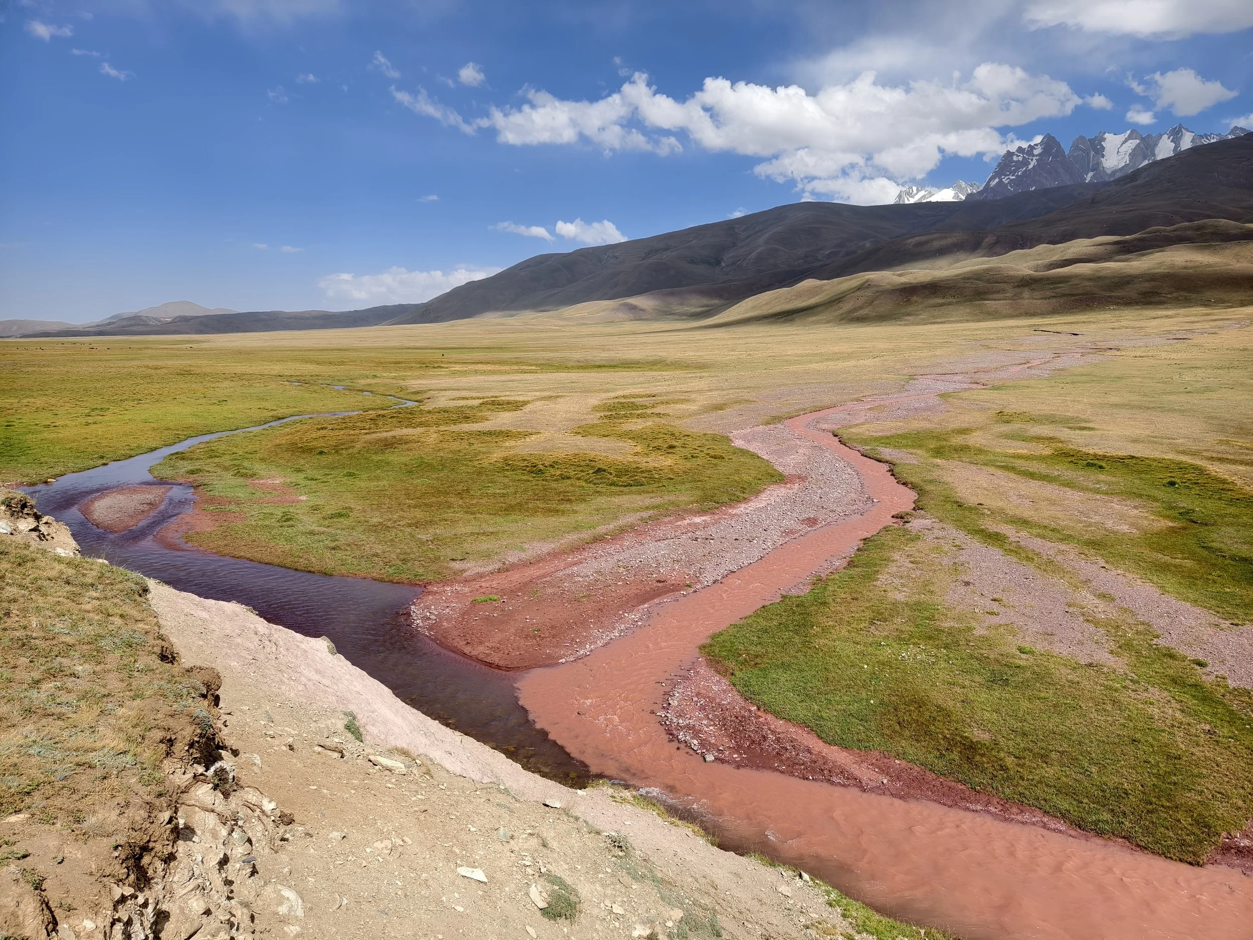
Along the red Qaroshura River - pic: M. Hrda
Stage 46: Dashti Murghon - Vayzirek
Distance: 19.1km
Ascent: 891m
Descent: 380m
Trail: easy - clear track and trails

Landmine sign, check stage info! - pic: C. Oriol
Stage 47: Vayzirek - Puli Sangin
Distance: 16.8km
Ascent: 762m
Descent: 726m
Trail: moderate - variable trails

Approach to Gardani Kaftar Pass - pic: C. Oriol
Stage 48: Puli Sangin - Langar
Distance: 18.9km
Ascent: 904m
Descent: 1777m
Trail: hard - variable trails
Psoda Lake - pic: M. Merisi
Stage 49A: Langar - Psoda Lake
Distance: 19km
Ascent: 1146m
Descent: 215m
Trail: moderate - road and clear trails

Looking back from Psoda Pass - pic: M. Merisi
Stage 50A: Psoda Lake - Siyohdara
Distance: 10.7km
Ascent: 983m
Descent: 729m
Trail: hard - vague or no trails

Along the Siyohdara river - pic: M. Merisi
Stage 51A: Siyohdara - Gshun
Distance: 18.2km
Ascent: 226m
Descent: 1077m
Trail: moderate/hard - variable trails

Back in habitation - pic: M. Merisi
Stage 52A: Gshun - Qalai Khumb
Distance: 24.9km
Ascent: 169m
Descent: 1284m
Trail: easy - dirt track and rough road
———————————————————————————-
Section 6A is designed to be an easier, safer and lower route between the Rasht and Darvoz Districts across the 3850m high Psoda Pass. For now it ends in Qalai Khumb, but the Pamir Trail team is working on the extension between Qalai Khumb and Vanj. For now, the only feasible way to reach Vanj and continue the Pamir Trail is to get transport between the places. If you’re a purist you could hike the roughly 100km but it is very unpleasant and with the traffic sometimes even dangerous. We’re trying to find an efficient way to help you finding a car, as shared taxis and mini-busses are unreliable on this stretch of the Pamir Highway. Get in touch for advice.
———————————————————————————-
SECTION 6B: RASHT TO DARVOZ - HIGH ROUTE
Vahdat (Jirgatol) - Vanj * 208km * download stage descriptions * highest point Starghi Pass 4473m * trail beta stage 45-56B

Looking back to the Rasht Valley - pic: M. Merisi
Stage 45: Vahdat - Dashti Murghon
Distance: 17km
Ascent: 940m
Descent: 370m
Trail: easy - road, clear track
Along the red Qaroshura River - pic: M. Hrda
Stage 46: Dashti Murghon - Vayzirek
Distance: 19.1km
Ascent: 891m
Descent: 380m
Trail: easy - clear track and trails
Landmine sign, check stage info! - pic: C. Oriol
Stage 47: Vayzirek - Puli Sangin
Distance: 16.8km
Ascent: 762m
Descent: 726m
Trail: moderate - variable trails
Approach to Gardani Kaftar Pass - pic: C. Oriol
Stage 48: Puli Sangin - Langar
Distance: 18.9km
Ascent: 904m
Descent: 1777m
Trail: hard - variable trails

Small stretch of road near Langar - pic: J. Bakker
Stage 49B: Langar - Sangoba
Distance: 13.1km
Ascent: 1103m
Descent: 40m
Trail: moderate - clear trails

Satellite image Vereshkay Pass 3970m - pic: FATMAP
Stage 50B: Sangoba - Rogha
Distance: 16.2km
Ascent: 880m
Descent: 1546m
Trail: hard - vague or no trails
-WARNING: STAGES 51B - 55B HAVE BEEN TESTED, BUT IT PROVED TO BE VERY HARD. EXPECT ROUTE SECTIONS WITHOUT TRAIL, OVERGROWN TERRAIN AND DEEP FAST-FLOWING RIVERS. WE ADVISE TO DO THIS PART OF THE PAMIR TRAIL FROM THE LAST WEEK OF SEPTEMBER, NOT EARLIER AS SOME RIVERS ARE LIKELY TO BE IMPASSABLE. WE AIM TO IMPROVE / ADD INFRASTRUCTURE TO OVERCOME THESE NATURAL BOUNDARIES.-

Upper Khingov Valley - pic: J. Bakker
Stage 51B: Rogha - Nusay
Distance: 12.1km
Ascent: 312m
Descent: 194m
Trail: easy/moderate - clear track and vague trails

Looking back to Batrud / Khingov - pic: Lottie GD
Stage 52B: Nusay - Rovak
Distance: 14.9km
Ascent: 591m
Descent: 396m
Trail: hard - clear, vague and sometimes no trails

View across Dashti Burs - pic: Lottie GD
Stage 53B: Rovak - Sagdar
Distance: 13.8km
Ascent: 563m
Descent: 199m
Trail: very hard - no trails

The Tagargob/Obistarghi Valley - pic: Lottie GD
Stage 54B: Sagdar - Tagargob
Distance: 7.9km
Ascent: 597m
Descent: 26m
Trail: very hard - no trails

Crossing the Starghi Pass - pic: Lottie GD
Stage 55B: Tagargob - Stargh
Distance: 15.7km
Ascent: 956m
Descent: 2483m
Trail: very hard - glacier, various or no trails

Aerial view into the Vanj Valley - pic: J. Bakker
Stage 56B: Stargh - Vanj
Distance: 43.8km
Ascent: 362m
Descent: 787m
Trail: easy - dirt road
SECTION 7: VANJ AND YAZGHULOM
Vanj - Nisur * 203km * download stage descriptions * highest point Odudi Pass 4450m * trail beta stage 57-65

Below the Gushkhun Pass - pic: M. Merisi
Stage 57: Vanj - Gushkhun
Distance: 10.2km
Ascent: 2163m
Descent: 40m
Trail: moderate/hard - variable trails

Tricky descent to Zhamag- pic: M. Merisi
Stage 58: Gushkhun - Zhamag
Distance: 10.3km
Ascent: 524m
Descent: 2401m
Trail: very hard - variable and no trails

Easy road hike in Yazghulom Valley - pic: M. Merisi
Stage 59: Zhamag - Motravn
Distance: 18.1km
Ascent: 323m
Descent: 588m
Trail: easy - track / road

Crossing the river Darai Motravn - pic: D. Hardwick
Stage 60: Motravn - Khanil
Distance: 11.3km
Ascent: 1539m
Descent: 269m
Trail: easy / moderate - clear trails

Crossing the Odudi Pass 4450m - pic: E. Huisman
Stage 61: Khanil - Vamardara
Distance: 12.9km
Ascent: 1482m
Descent: 876m
Trail: hard - variable and no trails

Amazing descent to Rushon - pic: J. Bakker
Stage 62: Vamardara - Rushon
Distance: 13.7km
Ascent: 94m
Descent: 1706m
Trail: easy / moderate - clear trails

Hiking along the Bartang river - pic: J. Bakker
Stage 63: Rushon - Siponj
Distance: 46.9km
Ascent: 679m
Descent: 495m
Trail: easy - dirt road and clear trails
The wonderful Bartang Valley - pic: M. Merisi
Stage 64: Siponj - Basid
Distance: 41km
Ascent: 1122m
Descent: 929m
Trail: easy - dirt road and clear tracks

Not bad for a road hike! - pic: J. Bakker
Stage 65: Basid - Nisur
Distance: 40.3km
Ascent: 1042m
Descent: 798m
Trail: easy - dirt road
THE BARDARA DIVERSION
Basid - Zaroshkul * 49km * download stage descriptions * highest point Shtek Lozar Pass 4796m * trail beta stage BD 1-4

Bardara Village in bloom - pic: J. Bakker
Stage BD 1: Basid - Bardara
Distance: 15.6km
Ascent: 642m
Descent: 166m
Trail: easy - clear track
Crossing the Bardara River - pic: Pamir Eco Tourism
Stage BD 2: Bardara - Shedavi
Distance: 12.9km
Ascent: 610m
Descent: 24m
Trail: moderate - clear trails
Hiking up the Bardara Valley - pic: J. Bakker
Stage BD 3: Shedavi - Mana River
Distance: 7.3km
Ascent: 330m
Descent: 46m
Trail: moderate - clear trails

Crossing the Shtek Lozar Pass - pic: J. Bakker
Stage BD 4: Mana River - Zaroshkul
Distance: 13.4km
Ascent: 1112m
Descent: 292m
Trail: very hard - vague / no trails / glacier
SECTION 8: RUSHON
Nisur - Bachor * 95km+15km boat (102km without boat) * download stage descriptions * highest point Lower Vikhinj Pass 4576m * trail beta stage 66-71

Barchidev from above - pic: J. Bakker
Stage 66: Nisur - Barchidev
Distance: 8.9km
Ascent: 494m
Descent: 439m
Trail: easy - clear track and trails

Crossing the Marghob River - pic: J. Bakker
Stage 67: Barchidev - Sarez
Distance: 18.9km
Ascent: 1300m
Descent: 658m
Trail: moderate/hard - variable trails

Hiking up the Langar Valley - pic: J. Bakker
Stage 68: Sarez - Langar
Distance: 12.7km
Ascent: 490m
Descent: 16m
Trail: moderate - clear trails

The splendid Zaroshkul - pic: J. Bakker
Stage 69: Langar - Zaroshkul
Distance: 20km
Ascent: 1036m
Descent: 108m
Trail: moderate - clear trails

Approaching the turquoise Taskilkul - pic: J. Bakker
Stage 70: Zaroshkul - Kafkrud
Distance: 16km
Ascent: 105m
Descent: 874m
Trail: moderate/hard - variable trails
Heading down to Bachor - pic: M. Merisi
Stage 71: Kafkrud - Bachor
Distance: 17.4km
Ascent: 59m
Descent: 486m
Trail: easy - clear trails
SECTION 9: SHUGHNON AND SHAKHDARA
Bachor - Vrang * 117km * download stage descriptions * highest point Vrang Pass 5010m * trail beta stage 72-79

The Ghund Valley - pic: J. Bakker
Stage 72: Bachor - Duzakhdara
Distance: 26.5km
Ascent: 171m
Descent: 288m
Trail: easy - clear track and road

Hiking up the Duzakhdara Valley - pic: J. Bakker
Stage 73: Duzakhdara Valley
Distance: 11km
Ascent: 838m
Descent: 45m
Trail: moderate - variable trails

Views from the Duzakhdara Pass - pic: J. Bakker
Stage 74: South Duzakhdara
Distance: 13.6km
Ascent: 407m
Descent: 408m
Trail: easy - mostly clear trails

The valley towards Shakhdara - pic: J. Bakker
Stage 75: South D’dara - Rubot
Distance: 21.1km
Ascent: 19m
Descent: 698m
Trail: easy - clear track

A gorge near Rubot village - pic: J. Bakker
Stage 76: Rubot - Vrang River
Distance: 15km
Ascent: 748m
Descent: 31m
Trail: easy - clear track and trails
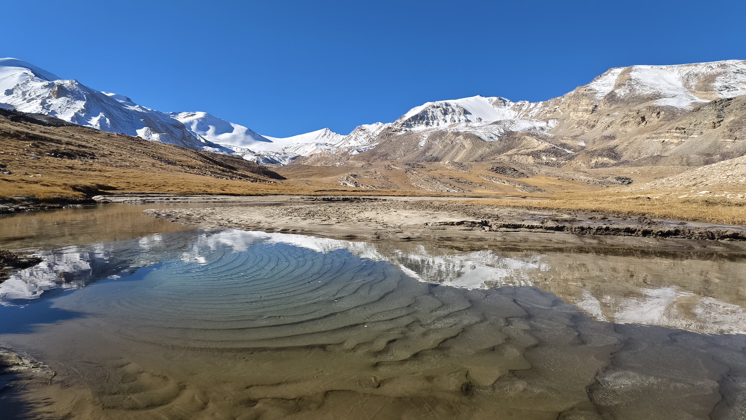
View towards the Vrang Pass - pic: M. Hrda
Stage 77: Vrang River - Vrang Lakes
Distance: 5.6km
Ascent: 408m
Descent: 0m
Trail: moderate - variable trails

Steep descent after the Vrang Pass - pic: J. Bakker
Stage 78: Vrang Lakes - Vnukut
Distance: 14.1km
Ascent: 581m
Descent: 1145m
Trail: very hard - vague or no trail, exposed terrain

Exposed terrain, lower Vnukut Valley - pic: J. Bakker
Stage 79: Vnukut - Vrang
Distance: 10.7km
Ascent: 97m
Descent: 1212m
Trail: hard - variable trails, exposed terrain

Visual of stage 80-81 - pic: J. Bakker
Stage 80-81: Vrang (TJ) - Ouezed (AF)
Distance: 48.1km
Ascent: 461m
Descent: 343m
Trail: easy - track
PAMIR TRAIL EXTENSION: THE AFGHAN PAMIRS
Ouezed - Sarhad-e-Broghil * 163km * download stage descriptions * highest point Shawr Pass 4895m * trail beta stage 82-91
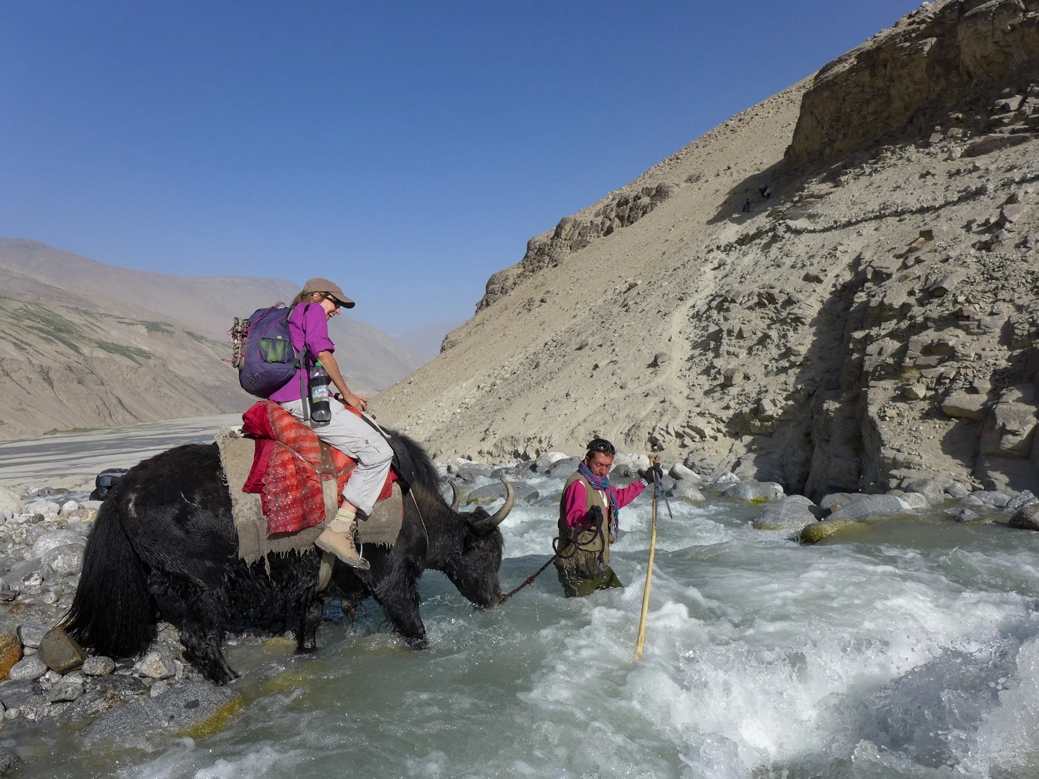
Crossing a river on a yak - pic: J. Bakker
Stage 82: Ouezed - Ouezed Dara
Distance: 7.7km
Ascent: 1125m
Descent: 46m
Trail: easy/moderate - clear trail

View from Mulungdan - pic: J. Bakker
Stage 83: Ouezed Dara - Mulungdan
Distance: 13.7km
Ascent: 660m
Descent: 357m
Trail: easy/moderate - clear trails

Crossing the Shikarga river on horse - pic: J. Bakker
Stage 84: Mulungdan - Manjalaq
Distance: 20.1km
Ascent: 480m
Descent: 685m
Trail: moderate - variable trails

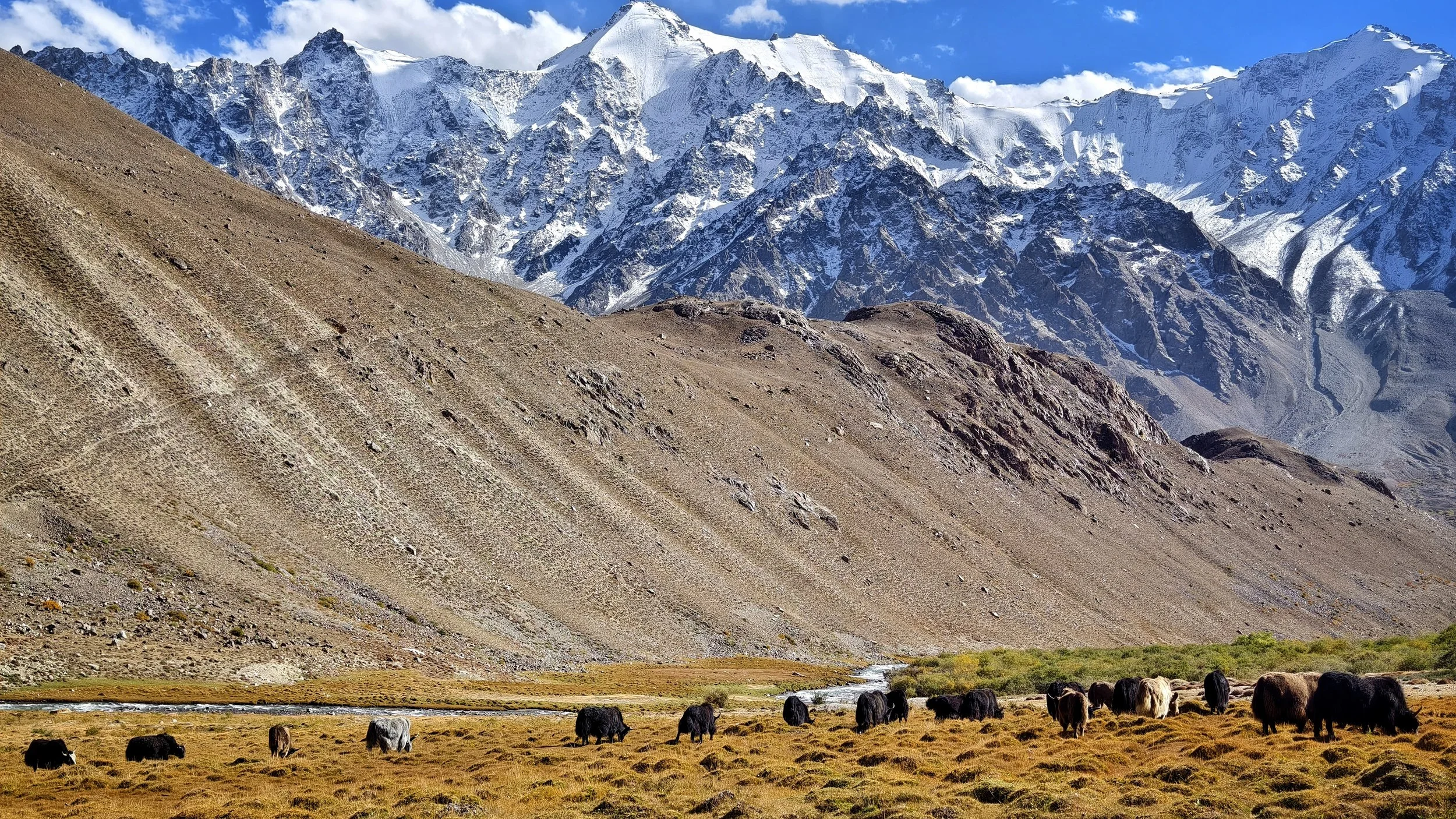
Yak caravan in the Big Pamir - pic: J. Bakker
Stage 85: Manjalaq - Jilmasert
Distance: 19.2km
Ascent: 741m
Descent: 516m
Trail: easy/moderate - clear trail

Crossing the Teelabay river - pic: J. Bakker
Stage 86: Jilmasert - Arghunuk
Distance: 23.3km
Ascent: 561m
Descent: 613m
Trail: easy/moderate - clear trails

Looking across to Tajikistan - pic: J. Bakker
Stage 87: Arghunuk - Dasht-e-Mula
Distance: 17.9km
Ascent: 533m
Descent: 405m
Trail: easy/moderate - variable trails

Last camp before the Shawr Pass - pic: J. Bakker
Stage 88: Dasht-e-Mula - Foot Shawr
Distance: 11.9km
Ascent: 253m
Descent: 234m
Trail: moderate - variable trails

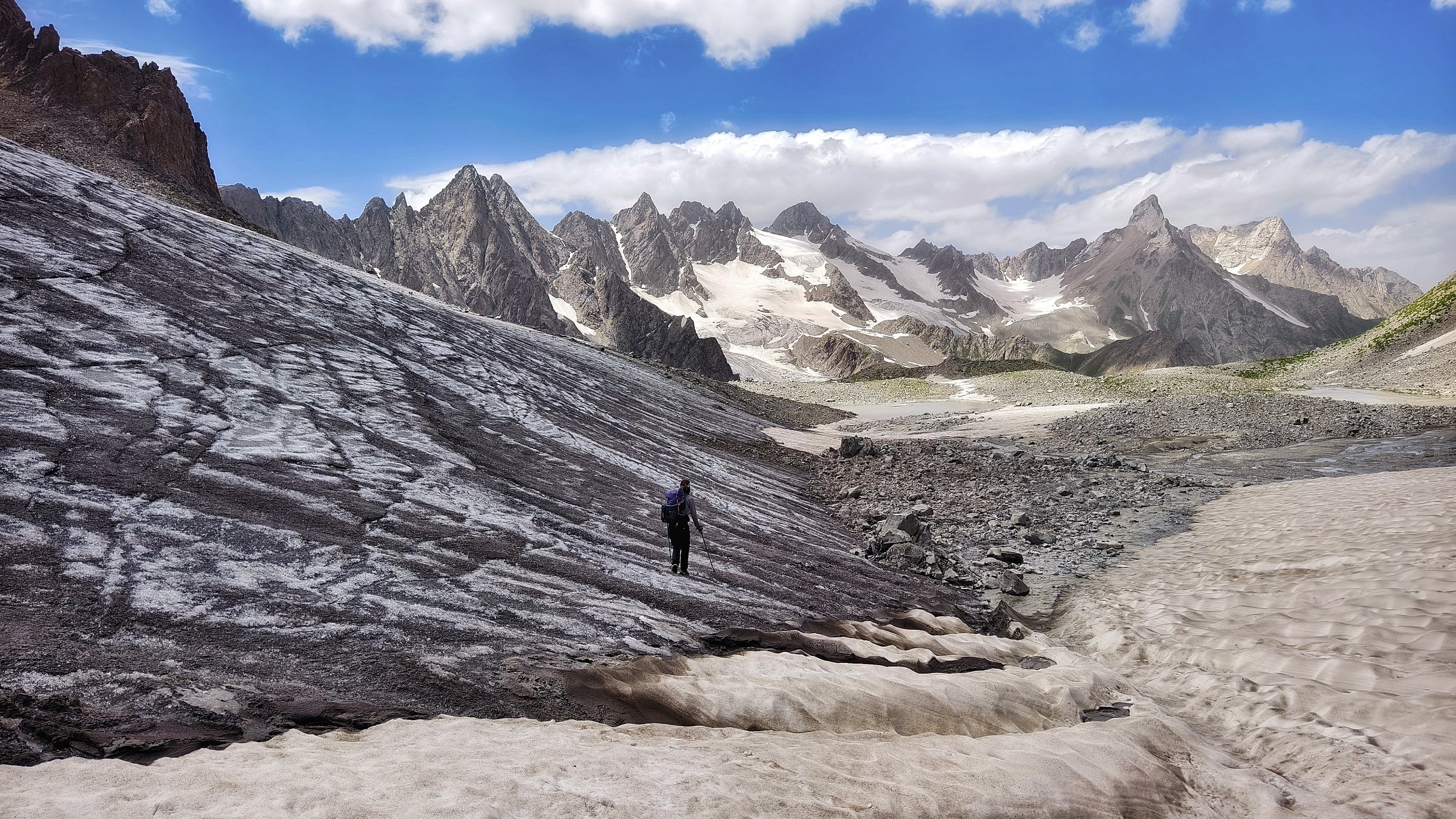
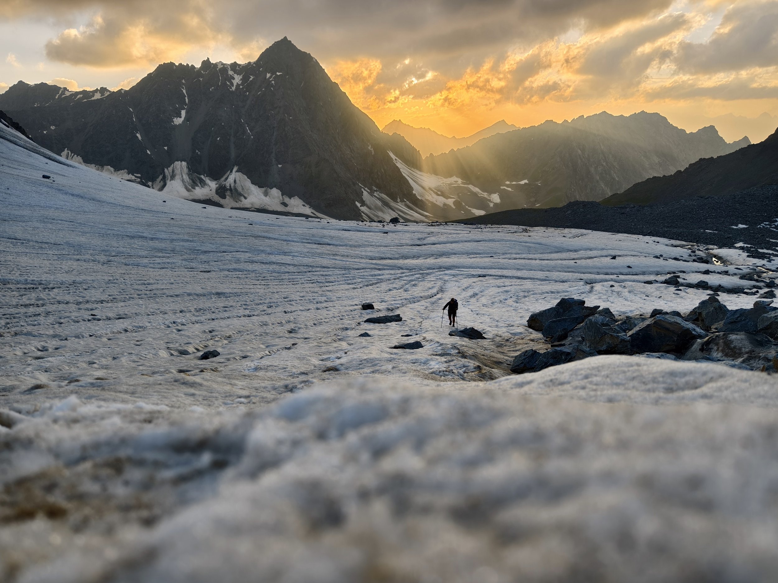
Trek on the glacier on the Shawr Pass - pic: J. Bakker
Stage 89: Foot Shawr - Qarabel
Distance: 20km
Ascent: 495m
Descent: 804m
Trail: hard - variable or no trails

Yaks are the best expedition animal! - pic: J. Bakker
Stage 90: Qarabel - Foot Dara Bik
Distance: 14.7km
Ascent: 653m
Descent: 252m
Trail: moderate - variable trails

The Dara Bik Pass East at 4720m - pic: J. Bakker
Stage 91: Foot Dara Bik - Sarhad
Distance: 12.7km
Ascent: 349m
Descent: 1551m
Trail: hard - variable trails